Is Lake Bovilla Worth Visiting?
Whether Lake Bovilla near Tirana is worth the drive, what the reservoir and Gamti mountain offer, and how to plan the trip.
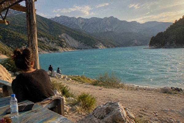
Lake Bovilla is the reservoir that supplies Tirana, the inland capital of Albania at the foot of Mount Dajti, and it sits about 21 km and roughly 61 minutes by road from Skanderbeg Square. The question of whether it is worth visiting depends on what a traveller wants from a half day outside the city: the reservoir's turquoise water inside a steep rocky basin is genuinely striking, but the site is a water-supply lake, not a developed recreation area, and the road to reach it is part of the experience.
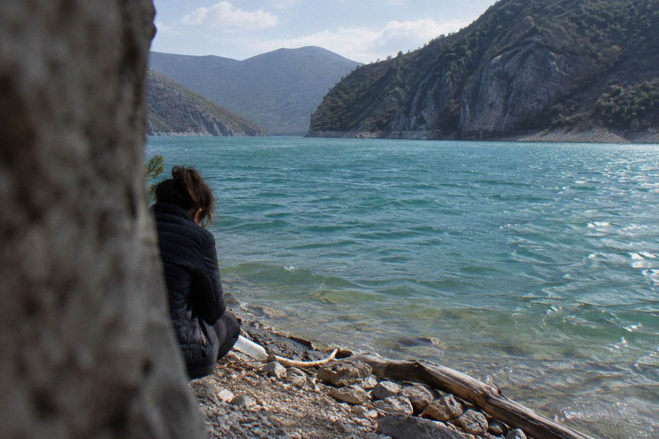
Yes, for travellers who want dramatic scenery close to Tirana and do not expect a beach or a built-up resort, Lake Bovilla is worth the trip: the reservoir sits in a steep limestone basin with vivid blue-green water, about 61 minutes and 21 km by road from Skanderbeg Square, and the hike up Gamti mountain above the dam gives the wide view the shoreline itself does not. It is a half-day photography and hiking destination, not a swimming or facilities destination, and the road up is winding. Anyone expecting laid-back infrastructure should adjust expectations before setting out.
The lake was built as Tirana's drinking-water reservoir, which shapes what a visit looks like. The water is the draw, framed by pale rock walls, and the panorama opens up properly from height rather than from the shore. The Gamti mountain trail is the standard route to that viewpoint, and a guided option such as the Bovilla Lake and Gamti Hike covers the transfer and the trail in one booking. The full picture of the area is on the Lake Bovilla day-trip guide.
What Do You Actually See And Do At Lake Bovilla?
The visit has three parts: the dam and reservoir viewpoints with their turquoise water against limestone walls, the hike up Gamti mountain to the classic elevated panorama, and the winding mountain road itself, which passes canyon scenery on the way out of the Tirana basin. There is no promenade, no developed beach and no swimming culture at the reservoir, since it is a drinking-water source. The reward is photographic: rock, water and sky, with Tirana's Dajti massif visible on clear days.
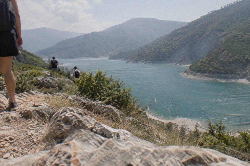
The Gamti trail is the centrepiece. It climbs from the dam area to a ridge where the reservoir's full shape appears below, a shape the shoreline view only hints at. Hikers should bring proper shoes and water, since the route is a mountain path rather than a groomed track. Anyone comparing outdoor options around the capital can weigh it against the choices in the hiking near Tirana guide. Independent travellers need a car or a taxi arranged in advance; there is no city bus to the reservoir.
The contrast with the city is the point. Skanderbeg Square, the Bunk'Art museums and the Blloku cafe quarter are all within a few kilometres of the centre, while Bovilla feels like proper mountain country within an hour's drive. That combination, an inland capital with alpine water this close, is unusual, and it is the reason the reservoir appears on so many Tirana itineraries despite having almost no visitor infrastructure.
The lack of infrastructure cuts both ways. There is no ticket desk, no cafe guaranteed to be open and no signposted circuit of the shore, which keeps the place quiet and unpolished but also means visitors carry everything they need for the morning. Weather changes quickly in the basin, and the viewpoint is exposed, so a windproof layer earns its place even on a warm day. For travellers who value solitude and raw landscape over amenities, that austerity is a feature rather than a flaw.
How Do You Get To Lake Bovilla From Tirana?
By car or arranged transfer it is about 21 km and roughly 61 minutes by road from Skanderbeg Square, on a winding route that leaves the city north-east towards the dam; there is no public bus to the reservoir, so independent visitors need a rental car, a taxi booked for the round trip, or a guided tour that includes transport. The drive is part of the appeal, passing the Erzeni river gorge before the basin opens up, but the final stretch is narrow and slow.
Booking a guided day is the simplest route for visitors without a car. The tour above bundles the transfer, the Gamti hike and the viewpoints; the operator's live listing carries the current price, meeting arrangements and availability. Travellers who prefer their own wheels should read the driving considerations on the Albania travel tips page and note that Albania drives on the right. For context on how the day fits a wider plan, see How Many Days In Tirana Is Enough.
One practical note on timing: the road out of Tirana passes through the city's eastern suburbs before climbing, and morning commuter traffic can add a meaningful margin to the drive estimate. Setting out before the rush rather than after it protects the morning light at the viewpoint, which is when the water colour reads strongest. Allow a full half day door to door even though the raw distance looks short on the map.
How Does Lake Bovilla Compare With Other Tirana Day Trips?
Bovilla is the shortest dramatic-nature option on Tirana's day-trip list at roughly 61 minutes each way, compared with about 45 minutes to Kruja's castle and bazaar, 47 minutes to Pellumbas Cave, about 122 minutes to Berat and about 250 minutes to Theth, so it suits a half day where those others need a full day or an overnight. Its weakness is variety: Kruja adds history, Berat adds a UNESCO-listed old town, and Bovilla adds none of that.
| Day trip from Skanderbeg Square | Road distance | Drive time | Main draw | Trip shape |
|---|---|---|---|---|
| Lake Bovilla | about 21 km | about 61 minutes | Reservoir, Gamti hike | Half day |
| Petrela Castle | about 14 km | about 22 minutes | Castle viewpoint | Half day |
| Kruja | about 37 km | about 45 minutes | Castle, bazaar | Full day |
| Pellumbas Cave | about 26 km | about 47 minutes | Cave, canyon walk | Half day |
| Berat | about 125 km | about 122 minutes | UNESCO old town | Full day |
| Theth | about 172 km | about 250 minutes | Alpine village, hike | Overnight |
Drive times are rough guides rather than fixed figures, and traffic at the edge of Tirana can stretch them. The Lake Bovilla day-trip guide covers the close-in options in more detail, and pairing Bovilla with Petrela in one day is a common plan since they both sit within an hour of the centre. For a full comparison of the country's headline destinations, the things to do in and around Tirana overview lays out the menu.
The comparison also depends on the season. Bovilla's advantage is strongest in the warmer months, when the trail is dry and the water colour is at its most intense under summer light. In the wetter part of the year, roughly November through March, the trail turns muddy and the basin clouds over, and a castle town such as Kruja or Berat holds up better in poor weather than an exposed ridge does. A realistic plan builds the mountain day around a forecast, with a town alternative in reserve. More of these guides are collected on Tirana Albania Travel Guide.
What Is The Best Time Of Year To Visit Lake Bovilla?
Late spring through early autumn is the practical window: the ERA5 reanalysis for Tirana, 1991-2020, puts July and August mean highs near 30 C with only about 34 and 31 mm of rain respectively, while November averages about 139 mm of rain and a 16.5 C mean high, so summer offers the reliable clear skies the viewpoint needs and late autumn does not. Winter visits are possible but the trail is rawer and the views cloudier.
| Month (Tirana basin, ERA5 reanalysis 1991-2020) | Mean high | Mean low | Rain |
|---|---|---|---|
| May | 22.7 C | 12.5 C | 89 mm |
| July | 29.8 C | 19.1 C | 34 mm |
| August | 30.4 C | 19.5 C | 31 mm |
| October | 21.4 C | 12.2 C | 119 mm |
| November | 16.5 C | 8.0 C | 139 mm |
Summer heat on an exposed trail is the trade-off, so an early start matters in July and August. The figures above describe the Tirana basin, and the reservoir a few hundred metres higher runs a little cooler. Visitors fitting the trip into a longer stay can check the best month to visit Tirana for the full city picture.
May and September are the quiet middle ground: rainfall sits between the summer and autumn figures, temperatures are moderate for climbing, and the basin sees fewer weekend visitors than the peak weeks. October can still deliver clear mornings, but the rain totals climb quickly after it, and a wet trail on limestone is no place for thin-soled shoes.
Should You Take A Tour Or Go Independently?
A tour is the sensible choice for visitors without a car, since the operator's listing for the Bovilla Lake and Gamti Hike includes transport from Tirana and a guide on the trail, while independent travel works well for anyone with a rental car who is comfortable on mountain roads and does not need a guide to find the route. The decision usually comes down to wheels and confidence on narrow roads, not cost alone.
Independent visitors should plan the full round trip before setting out: confirm the route, allow more time than the drive estimate suggests, and carry cash for anything bought en route, since cards are not a safe assumption in rural spots. Reports on tipping and pricing habits vary, so check the practical pages before travelling. Whatever the choice, book or set out early: the light on the water is better in the morning, and the viewpoint trail is more pleasant before midday heat builds in summer.
Common Questions About Lake Bovilla Near Tirana
Is Lake Bovilla Worth Visiting?
Yes, if the goal is dramatic mountain scenery close to Tirana. The reservoir's turquoise water inside a limestone basin, viewed from the Gamti mountain trail, is one of the most photogenic landscapes within an hour of the capital, and the round trip fits a half day.
Can you swim in Lake Bovilla?
The reservoir is a drinking-water source for Tirana, and the site has no developed beach or swimming infrastructure. Treat it as a viewpoint and hiking destination rather than a swimming lake; the Adriatic coast at Durres is about 39 minutes further west by road from the capital for actual swimming.
How far is Lake Bovilla from Tirana?
About 21 km and roughly 61 minutes by road from Skanderbeg Square, on a winding mountain route with a narrow final stretch. Allow extra time beyond the estimate.
Is there a bus to Lake Bovilla?
No public bus runs to the reservoir. Options are a rental car, a taxi booked for the return trip, or a guided day tour with transport included.
Is the Gamti mountain hike difficult?
The trail is a mountain path rather than a groomed track, with a steady climb to the ridge viewpoint. Sturdy shoes, water and an early start in summer are the standard advice for it.
What is the best time of year for Lake Bovilla?
May through September, when the ERA5 reanalysis for the Tirana basin shows warm, comparatively dry months with July and August mean highs near 30 C. November averages about 139 mm of rain, making late autumn a poor bet for the viewpoint.