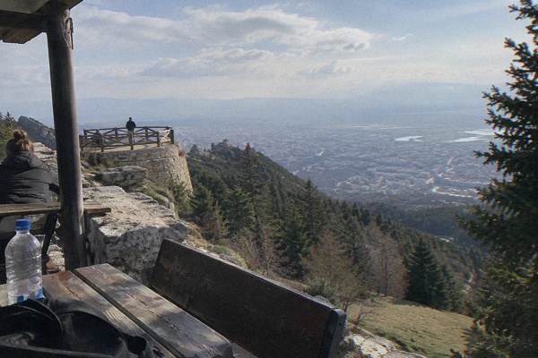
Hiking Near Tirana: Dajti, Bovilla And Gamti
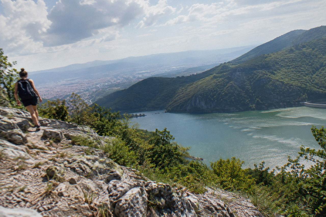
Tirana sits in a basin ringed by hills and mountains, and the walking starts almost at the edge of the city: Mount Dajti to the east, Lake Bovilla and Gamti Mountain to the north-east, Pellumbas Cave in the Erzeni valley. This guide lays out what each one offers, how to reach the trailheads, and what the seasons do to the ground underfoot.
Short answer
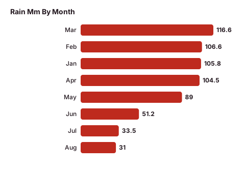
The three main hiking areas near Tirana are Mount Dajti (reached by the Dajti Ekspres cable car, which sells tickets only at its lower station), Lake Bovilla and Gamti Mountain about 61 minutes by road, and Pellumbas Cave about 47 minutes by road. Late spring to early autumn is the main season; the ERA5 reanalysis for Tirana puts November rainfall at 139 mm against 31 mm in August.
Tirana is the capital of Albania, an inland city in a basin at the foot of Mount Dajti, and that geography is the whole reason this guide exists: the walking starts at the edge of town, not hours away. Mount Dajti rises east of the city with a cable car linking it to the basin floor, Lake Bovilla and Gamti Mountain sit about 21 km and 61 minutes away by road, and Pellumbas Cave lies about 26 km and 47 minutes out in the Erzeni valley. The Adriatic coast at Durres is a separate day trip about 39 minutes west; none of the hikes in this guide are beach walks. For a full picture of the city between hikes, the Tirana Albania Travel Guide covers the centre, and our overview of things to do in Tirana slots outdoor days into a wider plan.
Where Can You Hike Near Tirana Without Going Far?
Four walking areas sit within about an hour of Skanderbeg Square: Mount Dajti and its national park about 53 minutes by road (or the cable car from the north-eastern edge of the city), Lake Bovilla about 61 minutes, Gamti Mountain above the Bovilla reservoir, and Pellumbas Cave about 47 minutes. All four are inland hill and mountain walks, since Tirana is not a coastal city. Petrela Castle, about 22 minutes by road, adds a short walk option on a castle hill.
That spread matters because it lets a visitor hike on a half day or a full day without an overnight. The Dajti Ekspres lower station sits about 4.4 km north-east of the square, so the cable car option barely involves driving at all. Bovilla, Gamti and Pellumbas all need road transport out of the basin, and the times above are road times from the centre without stops.
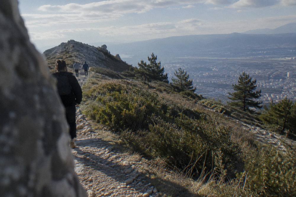
The walking itself ranges from plateau strolls on Dajti to steeper limestone terrain around Gamti and the gorge at Pellumbas. There is no trail-length or difficulty data for any of these routes in official sources, so treat any specific kilometre or gradient figure you read elsewhere with caution and confirm locally. What is verifiable is the geography: a mountain plateau on one side, a reservoir ringed by rocky ridges on the other, and a river cave in between.
The table below is the short version of the map. Distances and drive times are road figures from Skanderbeg Square.
| Area | Direction from the square | Road distance | Drive time | Character |
|---|---|---|---|---|
| Mount Dajti (national park) | East, summit 9.8 km as the crow flies | about 28 km | about 53 minutes | Mountain plateau, forest, viewpoints |
| Dajti Ekspres lower station | North-east | about 4.4 km within the city | short city hop | Cable car base, Bunk'Art 1 behind it |
| Lake Bovilla | North-east | about 21 km | about 61 minutes | Reservoir, dam, rocky shores |
| Gamti Mountain | Above Lake Bovilla | about 21 km plus track | about 61 minutes plus | Ridge walk, limestone terrain |
| Pellumbas Cave | East in the Erzeni valley | about 26 km | about 47 minutes | River gorge, cave mouth |
| Petrela Castle | South-east | about 14 km | about 22 minutes | Castle hill, short walks |
A half-day plan built around Dajti pairs naturally with the sights near the lower station, and our Dajti Ekspres attraction guide and the Mount Dajti National Park page cover both in detail.
How Do You Get Onto Mount Dajti From Tirana?
The Dajti Ekspres cable car runs from a lower station about 4.4 km north-east of Skanderbeg Square to the Dajti plateau, and tickets are sold only at that lower station, in one-way, return or combination versions that bundle the Mini Golf or Adventure Park. The operator's own page says the cable car is busy on national holidays and advises arriving between 09:00 and 11:00. No fare is published online, so check the current price at the lower station.
The operator bills the Dajti Ekspres as the longest cableway in the Balkans, Austrian-built, and that claim is the operator's own. Local reporting says the cableway is usually closed on Tuesdays for maintenance and otherwise operates from about 09:00, so confirm the day of the week before committing a morning to it. Our dedicated answer page, Is Dajti Express Worth It, weighs the practicalities.
The alternative is the road. The Mount Dajti summit area is about 28 km and 53 minutes by road from the square, which makes a car or a transfer the natural choice if the cable car is closed or crowded. Once on the plateau, the walking is the point: the national park covers the mountain top, and the terrain is a mix of forest tracks and open ground with views west over the whole Tirana basin. No official trail lengths, difficulty grades or summit elevation figures are available, so plan from maps on site rather than from numbers quoted online.
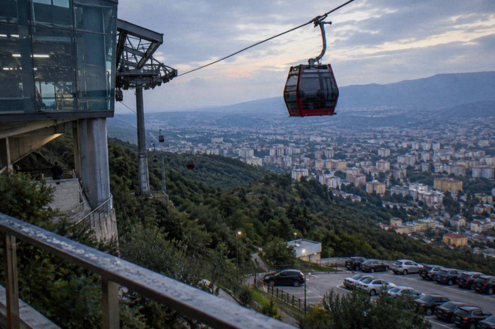
Bunk'Art 1, the bunker museum of the communist era, sits behind the lower station, which makes a combine easy: one visit covers a museum and a mountain. The Bunk'Art 1 guide has the opening hours, which the museum's own website lists as 09:30 to 17:30 daily since 1 June 2026.
| Dajti Ekspres fact | Detail |
|---|---|
| Lower station | about 4.4 km north-east of Skanderbeg Square |
| Tickets | Sold only at the lower station; one-way, return, combinations with Mini Golf or Adventure Park |
| Fares online | Not published; check the price at the lower station |
| Busy periods | National holidays; the operator advises arriving 09:00 to 11:00 |
| Weekly closure | Usually Tuesdays, per local reporting; confirm before you go |
| Operator claim | Billed as the longest cableway in the Balkans, Austrian-built |
Guided half-day options exist that bundle the cable car ride with pickup in the city, which sidesteps the ticket and timing questions.
The operator's live listing carries the current price, and booking covers the transport logistics that otherwise fall on you.
Is Lake Bovilla Worth The Hike From Tirana?
Lake Bovilla is the reservoir about 21 km and 61 minutes by road north-east of Tirana, ringed by rocky hills with Gamti Mountain rising above its shore, and the combination of lake walk and ridge climb is the most rewarding half or full day of hiking near the city after Dajti. No entry fee or trail data is published officially, so confirm access details locally before setting out.
The draw is contrast. The lake is a green reservoir held by a dam, and the terrain around it is dry limestone, closer to what people picture for the Albanian interior than to the forest of Dajti. Gamti Mountain is the ridge above the water: the walk up gains the panorama over the reservoir and back toward the Tirana basin. Our Lake Bovilla day-trip page and the answer to Is Lake Bovilla Worth Visiting cover the decision in more depth.
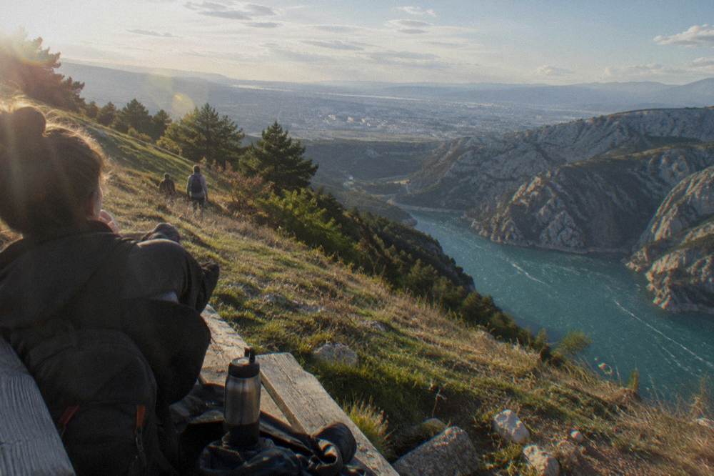
Getting there independently means driving or a transfer out of the city, since no public transport link covers the final stretch to the dam. The road time of about 61 minutes from the square, without stops, will run longer in traffic. Water, sun protection and proper shoes matter on this walk more than on Dajti: the limestone holds heat, and shade is limited on the ridge.
The featured tour on this page, the Bovilla Lake and Gamti Mountain day tour, exists precisely because the logistics are the hard part. It bundles transport from Tirana with the lake shore and the Gamti ridge in one booked day; details and availability are on the operator's live listing.
Wondering Whether To Book Or Go Alone?
A guided tour handles the two things that make Tirana hiking awkward without a car: the road out of the basin and the absence of marked, documented trails. Operators run set departures to Bovilla and Gamti, to Dajti with the cable car ticket included, and to farther walks such as Kruja's Sari Salltik viewpoint, all with free cancellation on the standard terms, so a change of weather costs nothing but notice.
Independent hiking from Tirana is possible, but it leans on a rental car or on local taxis for the final kilometres, and trail information on the ground is thinner than in the Alps or the Dolomites. Booking shifts that burden: pickup in the city, a guide who knows the track, and a fixed return time. For walkers who want the mountain without the planning, that trade is usually worth it.
What About Pellumbas Cave And Petrela Castle?
Pellumbas Cave sits about 26 km and 47 minutes by road east of Tirana in the Erzeni river valley, and its gorge-and-cave walk is the easiest genuine hike on this list, while Petrela Castle, about 14 km and 22 minutes south-east, adds a short castle-hill walk with basin views on days when a full trail is too much. No fees or hours for either site are published on official pages, so confirm locally.
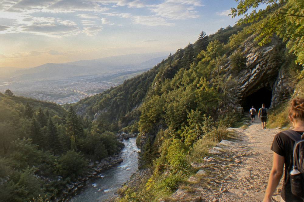
The Pellumbas walk follows the Erzeni valley to the cave mouth, a route that mixes riverside ground with a rocky final climb on steps and path. The cave itself is a large open chamber, and the setting, a gorge below bare cliffs, feels far more remote than the drive time suggests. As with the other trails here, no official source publishes a trail length or grade, so treat this as a half-day outing to be planned on site rather than a timed route.
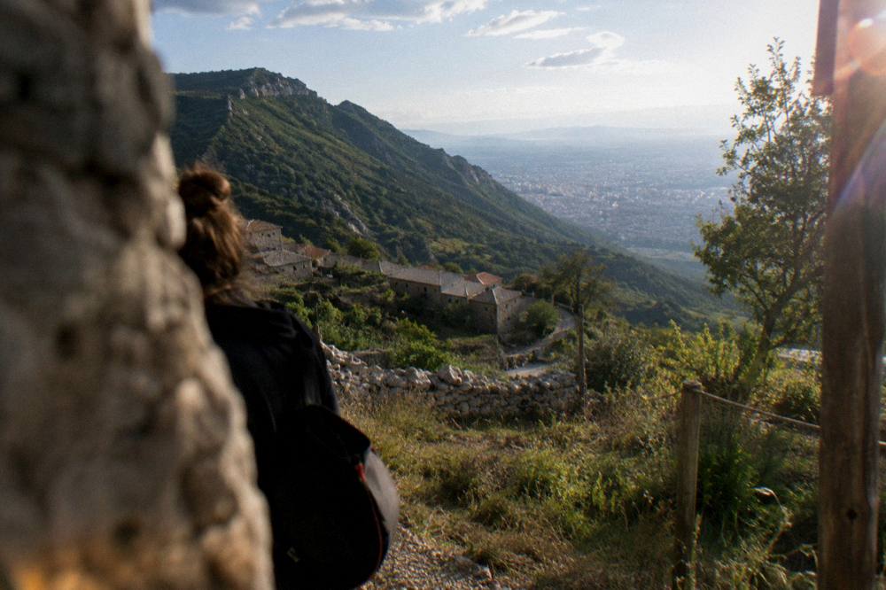
Petrela works as the light option. The castle stands on a hill above the village of the same name, and the walk up, combined with a loop of the surrounding ridge, fills a morning without needing gear beyond water and shoes. Petrela fees and hours are not published officially, so check the current arrangements at the gate before going. For anyone pairing a hike with history instead, the Kruja day trip below combines a castle, an old bazaar and the Sari Salltik viewpoint above it.
The listing carries the full itinerary and the current price.
How Hard Is Hiking Near Tirana Compared With The Albanian Alps?
Hiking near Tirana is half-day and full-day hill walking: Dajti's plateau, Bovilla's rocky shoreline and Gamti's ridge are all reachable without an overnight, whereas the Albanian Alps around Theth and Valbona are a different order of trip, about 172 km and 250 minutes by road to Theth, with the Valbona-Theth crossing reported at roughly 14 to 18 km and six to nine hours of walking. The Alps are an expedition from Tirana, not a day hike.
That distinction is worth stating plainly because guides sometimes blur it. Theth is about 250 minutes by road each way from the capital, which means the walk itself is not the day, the drive is. Local reporting puts the Valbona-Theth trail at 14 to 18 km and six to nine hours on foot, and the Komani lake ferry leg to Fierze at about 2.5 hours on the water, all of which points to an overnight in Shkoder or the valleys rather than a return to Tirana the same night.
Near the city, the scale is smaller. Gamti is a ridge, not a summit push; Dajti is a plateau served by a cable car; Pellumbas is a valley walk with one steep section. Anyone comfortable with a few hours on uneven ground can manage at least two of the three. Walkers wanting more can build the Alps into a longer loop through Shkoder, which is about 118 minutes by road north, and treat Tirana as the arrival and departure city rather than the base for the mountains themselves.
For a different angle on the same terrain, quad tours run out of the city toward the Bovilla side, and the listing carries the route and price.
| Destination | Road distance from Skanderbeg Square | Drive time | Walking scale |
|---|---|---|---|
| Lake Bovilla and Gamti | about 21 km | about 61 minutes | Half to full day, rocky ridge |
| Mount Dajti | about 28 km | about 53 minutes | Half day, plateau tracks |
| Pellumbas Cave | about 26 km | about 47 minutes | Half day, valley and gorge |
| Petrela Castle | about 14 km | about 22 minutes | Short walk, castle hill |
| Shkoder (gateway to the Alps) | about 98 km | about 118 minutes | Overnight base |
| Theth (Albanian Alps) | about 172 km | about 250 minutes | Multi-day, reported 14 to 18 km crossing |
When Is The Best Season For Hiking Near Tirana?
The main hiking season runs from late spring to early autumn: the ERA5 reanalysis for Tirana, 1991 to 2020, puts July at a mean high of 29.8 C and August at 30.4 C with only 34 and 31 mm of rain, while November carries 139 mm and December 138 mm, making the ridges around Bovilla wet, muddy or both. Winter walking on Dajti is possible but cold at altitude, with January mean lows of 2.3 C in the basin.
Summer heat is the real constraint on the exposed walks. Gamti and the Bovilla shoreline hold little shade, and a 30 C day on limestone is a different outing from the same route in May. Early starts solve this: the Dajti Ekspres operator itself advises arriving between 09:00 and 11:00, and the same logic applies to any trailhead. Autumn is the quiet compromise, with October showing a mean high of 21.4 C on the reanalysis table and the first of the heavy rain arriving in November.
Spring brings the green version of the same hills and the tail of the March-to-April rain, 116.6 mm in March on the same series. Whatever the month, check the forecast the day before: the basin and the ridge can sit in different weather. Our Tirana weather guide and the best time to visit Tirana page carry the full monthly picture.
| Month | Mean high C | Mean low C | Rain mm | Hiking note |
|---|---|---|---|---|
| Jan | 10.8 | 2.3 | 105.8 | Cold at altitude, wet ground |
| Feb | 12.0 | 2.9 | 106.6 | Muddy tracks |
| Mar | 15.0 | 5.1 | 116.6 | Green, changeable |
| Apr | 18.4 | 8.3 | 104.5 | Good spring walking |
| May | 22.7 | 12.5 | 89.0 | Comfortable, green |
| Jun | 26.9 | 16.6 | 51.2 | Warm, drier |
| Jul | 29.8 | 19.1 | 33.5 | Early starts for exposed ridges |
| Aug | 30.4 | 19.5 | 31.0 | Hot on limestone, lowest-rainfall ground |
| Sep | 25.7 | 16.0 | 98.9 | Post-summer heat eases |
| Oct | 21.4 | 12.2 | 119.1 | Mild days, rain returns |
| Nov | 16.5 | 8.0 | 138.6 | Highest-rainfall month on the series |
| Dec | 11.8 | 4.0 | 137.5 | Short, wet days |
ERA5 reanalysis, 1991-2020, grid cell over the Tirana basin.
What Should You Pack For A Tirana Day Hike?
Pack for dry limestone and sudden rain: proper shoes with grip, more water than feels necessary, sun protection, a layer for altitude on Dajti, and a rain shell outside the summer months, plus cash in lek for any local gate, taxi or small stop, since card coverage thins out beyond the city. The euro is not legal tender in Albania, and the lek trades at roughly 90 to the euro.
The shoe point is not cosmetic. Gamti and the ground above Bovilla are loose rock and scrub, and wet limestone after autumn rain is slippery in a way city trainers do not forgive. Water follows from the same terrain: there is no resupply point on any of these routes, so carry what the day needs from the start.
The layer is for Dajti specifically. The plateau sits well above the basin, and the temperature drop from a 21.4 C October afternoon in the city to the exposed top is real even without published elevation figures. In the city itself, the getting around Tirana guide covers buses and taxis for reaching trailheads and the lower station.
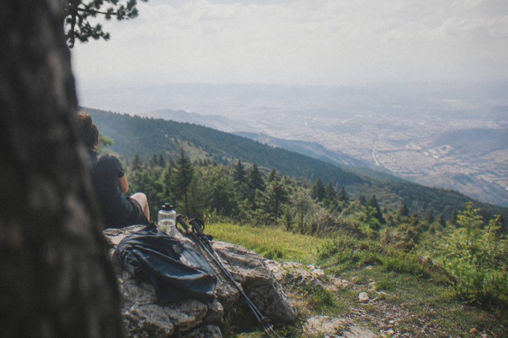
| Item | Spring (Mar-May) | Summer (Jun-Aug) | Autumn (Sep-Nov) | Winter (Dec-Feb) |
|---|---|---|---|---|
| Shoes with grip | Yes | Yes | Yes | Yes, mud-ready |
| Water | 1.5 L+ | 2 L+, early start | 1.5 L+ | 1 L |
| Sun hat and sunscreen | Yes | Essential | Yes | Optional |
| Rain shell | Yes | Rarely needed | Essential | Essential |
| Warm layer | Light | Very light | Yes | Yes, doubled |
| Cash in lek | Yes | Yes | Yes | Yes |
Should You Combine Hiking With A Longer Tirana Itinerary?
Yes: the hikes slot cleanly into a city stay, with Dajti as a half day attached to Bunk'Art 1 and the cable car, Bovilla and Gamti as a half or full day out, and Pellumbas or Petrela as shorter fillers, so a two-night visit can carry one mountain day and a four-night visit can carry two plus a rest day in Blloku or the centre. The two days in Tirana itinerary shows the shape of a balanced first visit.
The practical sequencing is simple. Put the cable car and Dajti on a clear morning, keep Bovilla for a day with a stable forecast since the ridge is exposed, and hold Pellumbas or Petrela as the flexible option when plans shift. Anyone flying in should read the airport to city centre guide first: the airport bus runs 24/7 at 400 lek and takes 30 to 40 minutes, which makes an afternoon arrival compatible with a first hike the next morning.
Safety framing for the hills themselves is common sense rather than statistics: tell someone your route, carry a charged phone, and know that Police 112, Ambulance 127 and Fire 128 are the emergency numbers in Albania. Current conditions in the centre are a separate matter, and the Is Tirana Safe? Scams, Traffic And Night Walks page tracks the October 2026 demonstration situation and official advice.
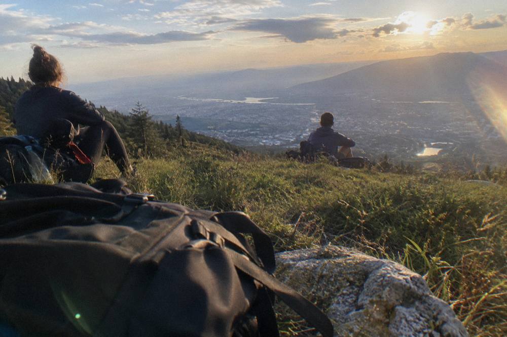
Common Questions About Hiking Near Tirana
Can you hike Mount Dajti without the cable car?
Yes. The summit area is about 28 km and 53 minutes by road from Skanderbeg Square, so a car, transfer or guided trip can reach the plateau directly, and walking up from the basin is also possible on footpaths. The cable car is the fastest and the most scenic way up, but it is not the only one; see the Dajti Ekspres guide for the details.
How far is Lake Bovilla from Tirana?
About 21 km by road, roughly 61 minutes from Skanderbeg Square without stops. Gamti Mountain rises directly above the reservoir, so the lake and the ridge are one destination, covered in the Lake Bovilla day-trip guide.
Is there good hiking inside Tirana itself?
Yes, at the city scale. Grand Park and the Artificial Lake sit about 2.1 km south-east of the square and make an easy loop, and the hills at the basin edge put real climbing within reach of the outer neighbourhoods. The mountain walks in this guide all start outside the built-up area.
What is the hardest hike near Tirana?
Of the walks on this page, the Gamti ridge above Bovilla is the most demanding, with rocky, exposed ground and no published trail data. Nothing near the city compares with the reported 14 to 18 km, six to nine hour Valbona-Theth crossing in the Albanian Alps, which is an overnight proposition from Tirana.
Do you need a guide to hike near Tirana?
Not strictly, but it helps. Trail marking and published route data are thin compared with Alpine standards, and the trailheads need road transport. A guided day tour to Bovilla and Gamti or a Dajti half-day with the cable car ticket included removes both problems.
When should you avoid hiking near Tirana?
Avoid November and December for the exposed routes if you can: the ERA5 reanalysis for 1991 to 2020 puts those months at 138.6 mm and 137.5 mm of rain respectively, and the limestone gets slippery. In July and August, with mean highs of 29.8 C and 30.4 C, start at dawn on the shadeless ridges.