Is Tirana Walkable?
Is Tirana walkable? A compact answer for the capital of Albania: which sights sit within walking distance of Skanderbeg Square, when to take a bus, and how the terrain and heat shape a day on foot.
Tirana, the capital of Albania, sits in a basin at the foot of Mount Dajti, roughly 37 km and 39 minutes by road from the Adriatic coast at Durres. That geography matters for anyone asking about walkability, because the city's sightseeing core clusters tightly around Skanderbeg Square while its outer districts and hills fan out beyond easy walking range. Central Tirana is a walking city, and almost everything a first-time visitor wants to see sits within a couple of kilometres of the square. The full picture, from pavement realities to bus rides and hills, is laid out below.
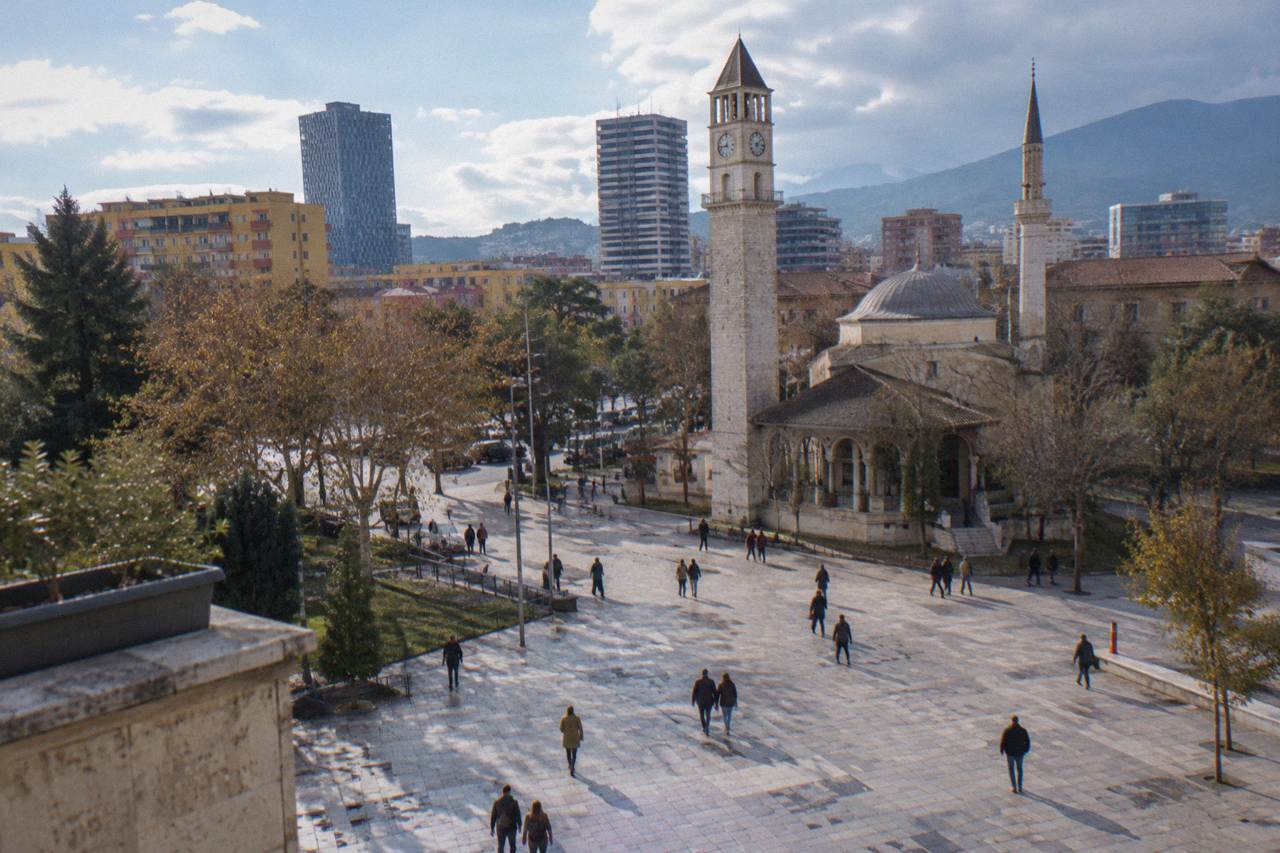
Yes, Tirana is walkable for sightseeing purposes: the Et'hem Bey Mosque, the Clock Tower, the House of Leaves, the Pyramid of Tirana, the Blloku cafe quarter and the New Bazaar all sit within about a kilometre of Skanderbeg Square, so a visitor can explore the historic centre entirely on foot. Walking range effectively ends at Bunk'Art 1 and the Dajti Ekspres cable car, both about 4.5 km north-east, where a bus or taxi becomes the practical choice.
Those distances are not guesswork. Straight-line positions measured from Skanderbeg Square put the Et'hem Bey Mosque and the Clock Tower about 0.2 km away, the Resurrection Cathedral about 0.2 km south, the Tirana Castle area about 0.5 km south-east, the Pyramid of Tirana about 0.7 km south-east, and Blloku about 0.8 km south. The Grand Park of Tirana and the Artificial Lake sit about 2.1 km south and south-east respectively, a comfortable extension for anyone happy with a longer stroll. In practice, a day built around the square can absorb almost every landmark in the city centre without any transport at all.
Tirana also rewards walking in a way many capitals do not, because its history is layered along short, connected streets. An Ottoman mosque stands beside a communist-era Palace of Culture; the Postbllok memorial, about 0.9 km south, carries a bunker, prison pillars and a piece of the Berlin Wall on one block; the once-restricted Blloku quarter is now the city's cafe and bar district. A route that strings these together covers under two kilometres end to end. For a structured version of that idea, the one day in Tirana itinerary sequences the walkable core hour by hour, and the deeper things to do in Tirana roundup lists what lies beyond walking range.
One caveat belongs in the first breath of any walkability answer: since 13 October 2026, demonstrations have been held in central Tirana, some violent, and the UK FCDO updated its travel advice on 15 October 2026, urging visitors to avoid demonstrations and check local media. The Tirana Marathon was moved from late October to 14 to 15 November 2026 as a result. Central Tirana remains perfectly walkable, but the current advice is to steer around crowds and protests rather than through them. More on that under safety below.
How Far Are Tirana's Main Sights On Foot?
Every headline sight in central Tirana lies within about 1.3 km of Skanderbeg Square: the Et'hem Bey Mosque at 0.2 km, the Pyramid of Tirana at 0.7 km, Blloku at 0.8 km, the New Bazaar at 0.6 km east and the Air Albania Stadium at 1.3 km south-east.
Only Bunk'Art 1 at 4.6 km north-east, the Dajti Ekspres lower station at 4.4 km north-east and the North-South bus terminal at 3.9 km north-west fall outside a comfortable walk.
The table below gathers the walking-relevant positions in one place. These are straight-line figures from the square, so actual pavement routes run somewhat longer.
| Sight or area | Direction from Skanderbeg Square | Straight-line distance |
|---|---|---|
| Et'hem Bey Mosque | south-east | 0.2 km |
| Clock Tower of Tirana | south-east | 0.2 km |
| House of Leaves | south-west | 0.2 km |
| Resurrection Cathedral | south | 0.2 km |
| Bunk'Art 2 | south-east | 0.2 km |
| Tirana Castle | south-east | 0.5 km |
| New Bazaar | east | 0.6 km |
| Great Mosque of Tirana | south-east | 0.6 km |
| Pyramid of Tirana | south-east | 0.7 km |
| Tanners' Bridge | east | 0.7 km |
| Blloku | south | 0.8 km |
| Postbllok Memorial | south | 0.9 km |
| Mother Teresa Square | south | 1.2 km |
| Grand Park of Tirana | south-east | 2.1 km |
| Dajti Ekspres lower station | north-east | 4.4 km |
| Bunk'Art 1 | north-east | 4.6 km |
A few pairings are worth building a day around. Bunk'Art 2 sits practically on the square, which makes it an easy add-on to the Et'hem Bey Mosque and the Clock Tower; Bunk'Art 1, by contrast, sits behind the Dajti Ekspres lower station in the north-eastern outskirts, so the two bunker museums are best combined into one outbound trip by bus or taxi. Visitors deciding between them can weigh the differences in the Bunk'Art 1 or Bunk'Art 2 comparison.
For anyone who would rather have a guide set the pace, several walks cover this same compact core. The trio below is a fair cross-section of what is on offer.
What Is Walking In Tirana Actually Like?
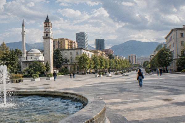
Walking in central Tirana means flat to gently sloping terrain, car-free sections around Skanderbeg Square, and a mixed pavement picture beyond it: the square was redesigned as a pedestrian space in 2017, while side streets range from new paving to broken kerbs. Heat is the main planning constraint, with July averaging a high of 29.8 C and August 30.4 C per the ERA5 reanalysis, 1991-2020. None of this stops a walking visit; it just shapes the timing of one.
The terrain is genuinely forgiving. The city centre sits on the basin floor, and the gradient only builds toward the south-eastern edge at the Grand Park and the Artificial Lake, where the walk climbs gently. The real climb in the region is Mount Dajti itself, whose summit lies 9.8 km from the square as the crow flies, and that is exactly what the Dajti Ekspres cable car is for. Visitors weighing that excursion can read the Is Dajti Express Worth It breakdown before committing.
Climate deserves a place in every walking plan. The ERA5 reanalysis, 1991-2020, gives Tirana January highs of 10.8 C and lows of 2.3 C, and November the largest monthly rainfall total at 139 mm, with December close behind at 138 mm. June through August are the dry months, with August rainfall down at 31 mm, but that is when the 30 C afternoons arrive. In summer the workable pattern is to walk mornings and evenings and shelter at midday; in November and December an umbrella matters more than sunscreen. The month-by-month detail sits in What Is The Best Month To Visit Tirana.
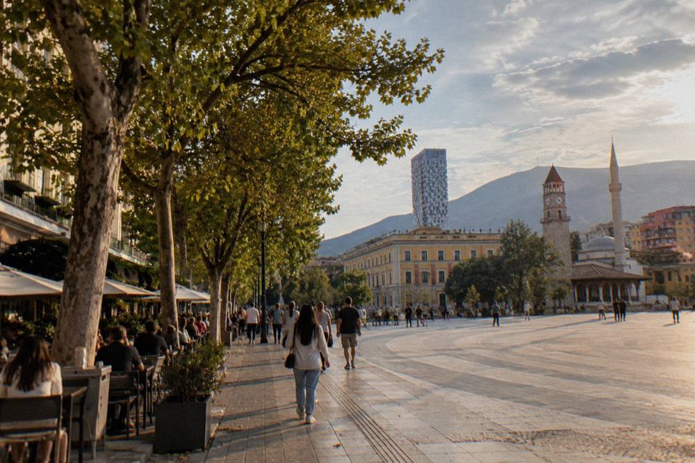
Pavement quality varies, and step-free access or pram-friendly routes cannot be confirmed anywhere in the city. Skanderbeg Square itself is a broad, stone-paved pedestrian expanse; the boulevards radiating from it have proper sidewalks; smaller back streets in areas like the New Bazaar are narrower and less even. Anyone with mobility constraints should treat a route check as part of the plan rather than assuming Western-European standards throughout.
When Should You Take A Bus Or Taxi Instead Of Walking?
Take a bus or taxi for anything beyond the central ring: Bunk'Art 1 and the Dajti cable car about 4.5 km north-east, the North-South intercity terminal 4.0 km north-west, and the airport at Rinas 15.9 km and about 29 minutes by road. City buses run roughly 06:00 to 23:00 with a flat fare of about 40 lek, paid in cash on board, and Uber and Bolt do not operate in Tirana, though local taxi apps do.
Treat that bus fare and those hours as approximate and confirm them on arrival. The intercity picture is firmer: the South and North Bus Terminal, 4.0 km north-west of Skanderbeg Square, publishes timetables on Tirana.al, with Durres buses from 06:00 at short intervals, Berat from 05:40 roughly every 30 to 45 minutes, and Shkoder from 05:00 about every 30 minutes. Intercity fares are not printed on official pages; the guidance is simply to pay the driver in cash, a few hundred lek for nearby towns. The national platform eTransport lists official lines and timetables. The rest of the planning pages sit on Tirana Albania Travel Guide.
For the airport there is a dedicated option: the official airport bus runs 24/7, departs every full hour, takes 30 to 40 minutes and costs 400 lek, stopping behind the Palace of Opera and Ballet near the square. That single line removes any need to plan a taxi for most flights. There is no airport train and no running Tirana-Durres train; the line is being rebuilt, with electrification expected to finish by the end of 2027.
A question heading this section deserves a direct answer about how walking and rides combine. The efficient pattern is a walking day in the centre punctuated by one or two motorised hops: a bus or taxi out to Bunk'Art 1 and the cable car, a bus to the intercity terminal on departure day. For everything inside the ring, walking wins. A guided walk is one way to make the central stretch carry more meaning, since the communist-era landmarks concentrate there.
Is It Safe To Explore Tirana On Foot?
Walking in Tirana is generally straightforward, with ordinary city precautions: watch your belongings in crowds and avoid demonstrations, which have been held in central Tirana since 13 October 2026, some violent, prompting the FCDO to update its advice on 15 October 2026. The emergency numbers are Police 112, Ambulance 127 and Fire 128. The US State Department, for its part, advises increased caution in Albania generally.
The current-conditions note matters specifically for walkers, because the demonstrations cluster in the very centre a visitor walks through, around Skanderbeg Square and the boulevards. The practical response is timing and awareness: check local media, keep clear of gathering crowds, and be flexible about rerouting a walk. Night walking gets its own dedicated treatment in Is It Safe To Walk Around Tirana At Night.
Two practical footnotes round out safety. The UK FCDO advises against drinking tap water in Albania and recommends bottled water only, which matters on long summer walks. And a note on orientation: a side-to-side head wobble often means yes in Albania while an upward chin lift can mean no, visitors report, so a local's gesture at a junction may be the opposite of what a Western walker expects.
How Many Walking Days Does Tirana Need?
Two full days walk the city comfortably: day one covers the square, the Et'hem Bey Mosque, the Clock Tower, the House of Leaves, Bunk'Art 2 and the Pyramid of Tirana, all inside a kilometre, and day two takes in Blloku, the Grand Park, the New Bazaar and an outbound hop to Bunk'Art 1 or the Dajti cable car. One day covers the essential core at a faster pace, and a third unlocks day trips.
The reasoning is arithmetic more than opinion. Day one's list never strays more than about 0.7 km from the square, so the constraint is museum time, not distance. The House of Leaves, about 0.2 km south-west of the square, is open 09:00 to 19:00 per its own site, and the National History Museum on the square itself is closed for restoration until about March 2028, its mosaic facade visible only from outside. Bunk'Art 1 lists daily opening of 09:30 to 17:30 since 1 June 2026 on its own website, with tickets bought at the door, since no price is published online. The Pyramid of Tirana, renovated and reopened in May 2023 as the TUMO tech centre, has steps that can be climbed outside for free.
Day two stretches the legs. Blloku sits 0.8 km south, the Grand Park and Artificial Lake 2.1 km out, and the New Bazaar 0.6 km east, so a loop ties them together in a morning. Whether that pace fits a short visit is argued out in How Many Days In Tirana Is Enough, and the broader case for the city at all is made in Is Tirana Worth Visiting For Tourists.
Beyond the city, walking becomes a bus or tour question. Berat lies about two hours away by road and is a full-day trip; the Albanian Alps at Theth are about four hours of driving each way and are an overnight proposition. The trio below covers one walk and two outings that slot into a multi-day Tirana plan.
Common Questions About Walking In Tirana
Is Tirana Walkable?
Yes. Nearly every central sight sits within about 1.3 km of Skanderbeg Square, and the core between the square, the Pyramid of Tirana, Blloku and the New Bazaar is a genuine walking district. Only Bunk'Art 1, the Dajti cable car and the bus terminals sit beyond comfortable walking range.
Is Tirana flat enough for easy walking?
The centre is flat to gently sloping, with a mild climb toward the Grand Park and Artificial Lake. The serious slopes are outside the walking core: Mount Dajti, reached by cable car, and the hills on the basin's rim.
Can you walk from Tirana airport to the centre?
No, and there is no reason to: the airport at Rinas is 15.9 km away, about 29 minutes by road. The official airport bus runs 24/7 every full hour for 400 lek and stops behind the Palace of Opera and Ballet near Skanderbeg Square.
Do you need a car in Tirana?
Not for the city itself. The centre is walkable, city buses run roughly 06:00 to 23:00 at about 40 lek cash per ride, and local taxi apps operate, though Uber and Bolt do not. A car earns its keep only for multi-stop day trips farther afield.
Is it safe to walk in central Tirana right now?
With precautions. Watch your belongings in crowds and avoid demonstrations, which have been held in central Tirana since 13 October 2026 and prompted updated FCDO advice on 15 October 2026. Police is 112, ambulance 127, fire 128.
The short version: pack walking shoes, plan around the summer heat and the current demonstration advisories, and save the wheels for Bunk'Art 1, the mountain and the bus terminal.