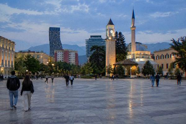
Sky Tower: The Revolving Bar Above Blloku
The Sky Tower stands about 0.7 km south of Skanderbeg Square in Tirana, on the edge of Blloku, and its revolving bar is its best-known feature. This guide covers where it is, how it compares with the city's other viewpoints, and how to build a day around it.
Short answer
The Sky Tower is a tower in central Tirana, about 0.7 km south of Skanderbeg Square beside the Blloku cafe quarter, known for its revolving bar. Confirm opening times and prices locally before you go.
The Sky Tower is one of the tall landmarks on Tirana's skyline, and its revolving bar above the Blloku quarter is what it is known for. Tirana, the capital of Albania, sits in an inland basin at the foot of Mount Dajti, so its towers and its mountains share the same horizon: from any high point in the city centre you look out over red-tiled rooftops toward the ridgeline to the east. This page, part of the Tirana Albania Travel Guide attractions series, covers where the Sky Tower sits, how to reach it, what you can see from high points in Tirana, and how to fold it into a wider day around Blloku and the city centre.
What Is The Sky Tower In Tirana?
The Sky Tower is a high-rise tower in central Tirana, about 0.7 km south of Skanderbeg Square, standing beside the Blloku cafe quarter, and its revolving bar is the feature it is billed for.
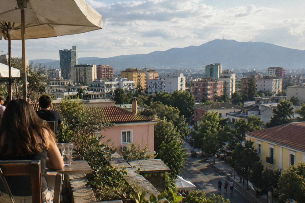
That is the honest shape of what a visitor needs to know. The tower is a private building rather than a museum or a ticketed attraction: you go up for the view and a drink, not for an exhibition. Its pull is geometric. Tirana's centre is low-rise for the most part, with the Pyramid of Tirana, the Clock Tower and a cluster of newer towers breaking the roofline, so a revolving bar even at mid-town height clears nearly everything around it. The rotation matters for photographers and for anyone who wants a slow circuit of the horizon without changing seats: over the course of a drink the room turns through the full panorama, from the Dajti massif in the east to the hills that close the basin in other directions.
Tirana is an inland city; the Adriatic coast at Durres is about 37 km and 39 minutes away by road, so no view in Tirana includes the sea. The mountains do the scenic work instead. Mount Dajti's summit is 9.8 km from Skanderbeg Square as the crow flies, and on a clear day it reads as a wall along the eastern edge of the city. If your mental picture of a "sky tower view" includes coastline, reset it before you arrive: this is a basin view, all rooftops, boulevards and ridges.
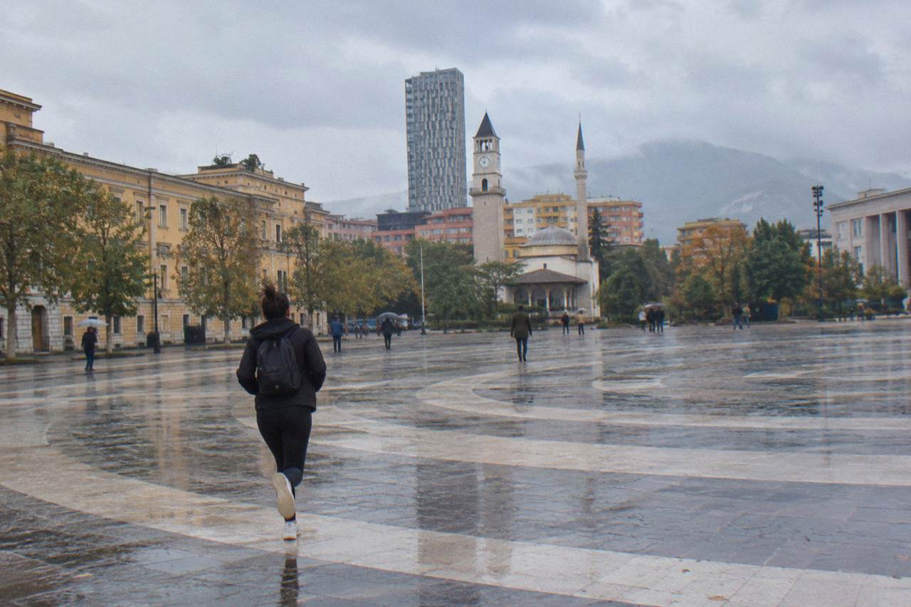
A practical note on timing your visit around current conditions. Demonstrations have been held in central Tirana since 13 October 2026, some of them violent, and the UK FCDO updated its travel advice on 15 October 2026 to tell visitors to avoid demonstrations and check local media. Skanderbeg Square and the main boulevards have been the focal points. Blloku, where the Sky Tower stands, is a few blocks off those axes, but it makes sense to check the news on the day and to keep plans flexible, especially for an evening visit.
Where Is The Sky Tower And How Do You Get There In Tirana?
The Sky Tower stands about 0.7 km south of Skanderbeg Square, on the edge of Blloku, which puts it within a 10 to 15 minute walk of the main square and within easy reach of the city bus network, whose single flat fare is about 40 lek paid in cash on board, per local reporting. Taxis are plentiful, and ride apps beyond Uber and Bolt operate in the city.
The walk from the square is the simplest approach. Head south from Skanderbeg Square past the government quarter, and Blloku begins about 0.8 km south of the square as a grid of leafy streets lined with cafes and bars. The tower sits at its edge, close enough to the centre that you will likely pass Rinia Park, about 0.4 km south of the square, on the way. The whole route is urban pavement, so wear whatever shoes you would wear for a city day.
For context, here is where the Sky Tower sits relative to other central landmarks, as the crow flies from Skanderbeg Square:
| Landmark | Direction from Skanderbeg Square | Straight-line distance |
|---|---|---|
| Sky Tower | south | about 0.7 km |
| Blloku (quarter) | south | about 0.8 km |
| Rinia Park | south | about 0.4 km |
| Pyramid of Tirana | south-east | about 0.7 km |
| Grand Park of Tirana | south-east | about 2.1 km |
| Bunk'Art 2 | south-east | about 0.2 km |
| Bunk'Art 1 | north-east | about 4.6 km |
Getting there by bus is straightforward in principle. City buses run roughly 06:00 to 23:00, and a single ride costs about 40 lek in cash paid to the conductor on board, so carry small notes. The main lines, including the Unaza ring line, pass within a short walk of Blloku. For planning any bus journey in Albania, the national platform eTransport lists official lines and timetables.
If you are arriving from the airport, the picture is simple: there is no airport train. The airport bus runs 24/7, every full hour, takes 30 to 40 minutes and costs 400 lek, stopping behind the Palace of Opera and Ballet near Skanderbeg Square, which is a comfortable starting point for the walk south to the tower. The official airport taxi costs about 2,200 lek one way. From there the tower is a stroll, not a journey.
Before or after you go up, a guided orientation of the streets below is worth considering. The Tirana Walking Tour: History, Culture & Hidden Local Gems covers the centre's layers with a local guide, and pairs naturally with a later ascent for the panorama.
Which Tirana Viewpoints Compare With The Sky Tower?
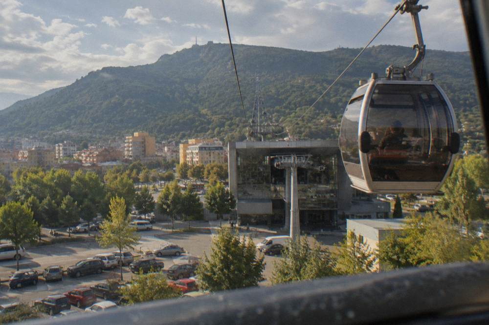
Tirana's other named viewpoints are the Pyramid's outside steps, which are free to climb per local guides, the Clock Tower with about 90 steps beside the Et'hem Bey Mosque, and the Dajti Ekspres cable car, which the operator bills as the longest cableway in the Balkans. Each gives a different slice of the same basin, and the Dajti line leaves every other viewpoint far below.
The comparison matters because the Sky Tower is not the only place to look down on Tirana, and the alternatives differ wildly in price and effort. The Pyramid of Tirana, about 0.7 km south-east of the square, was renovated and reopened in May 2023 as the TUMO tech centre, and its stepped exterior is reported to be open and free to climb; you get a low-height view over the boulevards for nothing. The Clock Tower, about 0.2 km south-east of the square beside the Et'hem Bey Mosque, has about 90 steps to the top; its fee and hours are not consistently published, so check at the venue. And the Dajti Ekspres cable car, with its lower station about 4.4 km north-east of the square, lifts you onto the mountain itself; the operator publishes no fares online and sells tickets only at the lower station, and it is usually closed on Tuesdays for maintenance, so plan around that and confirm before you go.
| Viewpoint | Distance from Skanderbeg Square | What you get | Cost basis |
|---|---|---|---|
| Sky Tower revolving bar | about 0.7 km south | A slow rotating panorama over the centre and Blloku | Confirm on site |
| Pyramid steps | about 0.7 km south-east | A low platform over the boulevards | Free to climb, per local guides |
| Clock Tower | about 0.2 km south-east | The classic old-town angle over the square | Check the current price at the venue |
| Dajti Ekspres | about 4.4 km north-east | The mountain view, far above the city | Tickets at the lower station only |
The honest framing is this: the Sky Tower is the comfortable option, the Pyramid is the free option, the Clock Tower is the historic option, and the Dajti Ekspres is the spectacular one. A well-built day can combine two of them. The cable car's lower station sits next to Bunk'Art 1, the anti-nuclear bunker museum open daily 09:30 to 17:30 since 1 June 2026, with tickets bought at the door, so a morning of history and mountain air can end with a revolving drink above Blloku. Our Tirana viewpoints guide works through the full list, and the Clock Tower page covers that climb in detail.
How Does The Sky Tower Fit Into A Day Around Blloku In Tirana?
A natural plan is a morning around Skanderbeg Square and the Pyramid, a midday wander through Pazari i Ri and the streets between, and an afternoon or early evening in Blloku ending at the tower's revolving bar, all within a walkable rectangle of roughly one kilometre on a side. Nothing in that circuit needs a car, and every leg is under 15 minutes on foot.
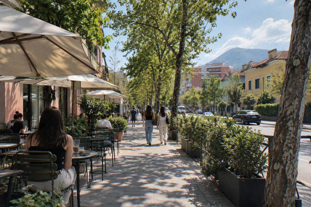
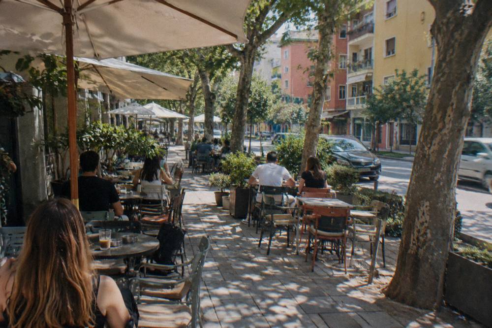
Blloku rewards slow time. It is the city's main bar and nightlife district, per several current city guides, a grid of plane-tree streets where cafes spill onto pavements and the evening starts late. Its other identity is historical: this was the former party-elite enclave, closed to ordinary citizens under the communist regime that ruled from 1944 to 1991, and the Blloku area guide covers that story alongside the practicalities. The Postbllok memorial, about 0.9 km south of the square at the quarter's edge, marks that past with a bunker, prison pillars and a fragment of the Berlin Wall. Villa 31, the former residence of Enver Hoxha, also stands in the quarter; the Enver Hoxha Villa page gives its context.
A sample day built around the tower looks like this:
| Time | Place | Notes |
|---|---|---|
| Morning | Skanderbeg Square | Free; the National History Museum is closed for restoration to about March 2028 |
| Late morning | Pyramid of Tirana and Bunk'Art 2 | Pyramid steps free per local guides; Bunk'Art 2 open daily from 09:30, tickets at the door |
| Midday | Pazari i Ri | About 0.6 km east of the square; the market quarter for lunch |
| Afternoon | Rinia Park into Blloku | About 0.4 km south, then the Blloku grid |
| Evening | Sky Tower | Revolving bar; confirm hours and prices on site |
Two cautions shape any 2026 version of that plan. First, the National History Museum on Skanderbeg Square is closed for restoration, with the announced closure running to March 2028; you can still see its mosaic facade from the square, but do not budget time inside. Second, the October 2026 demonstrations in central Tirana have already moved one major event: the Tirana Marathon was shifted from late October to 14 to 15 November 2026. Streets around the square can close with little notice, so keep the day's order swappable. The two days in Tirana itinerary offers a tested structure if you have more than one day.
For a deeper cut of the communist-era city before drinks in Blloku, the guided walks collected on our Tirana communism tour page take in Bunk'Art, the House of Leaves and the memorials in sequence, which sharpens what you see from above: from the tower, the Blloku grid below was once the regime's sealed compound.
What Can You See From High Points In Tirana?
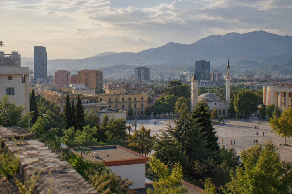
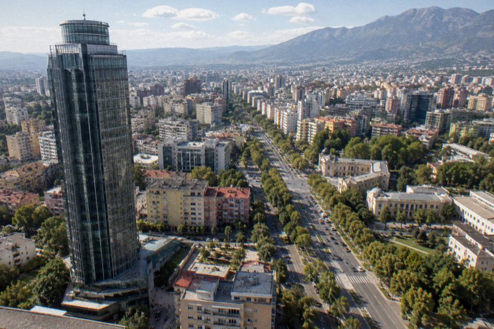
From any elevated point in central Tirana the view is of a low, dense city in a mountain basin: Mount Dajti's ridge dominating the east at 9.8 km from the square, the Grand Park and Artificial Lake to the south at about 2.1 km, and a skyline of tile roofs, minarets and new towers, with no sea visible because the coast at Durres is about 37 km away.
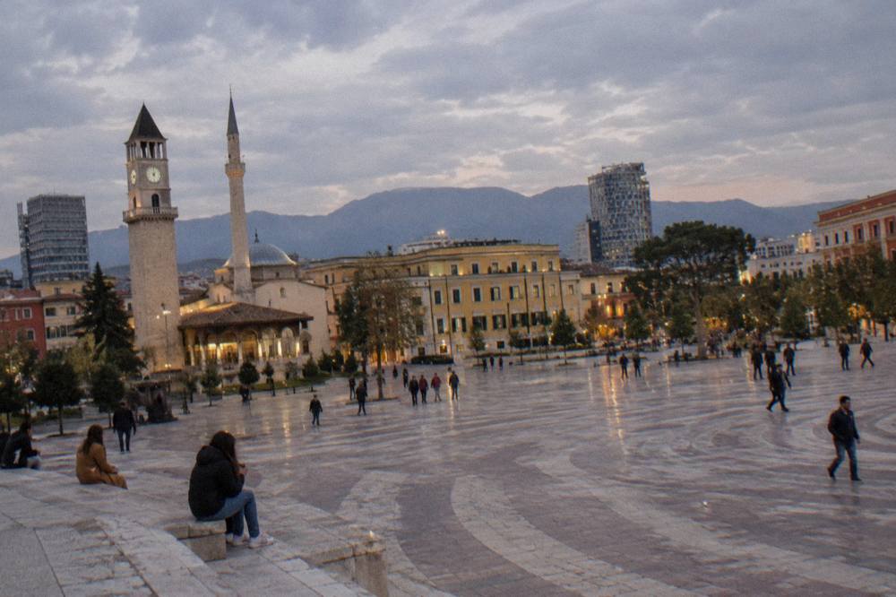
Learn to read the skyline before you go up and the view doubles in interest. Directly below the Sky Tower lies Blloku itself, a green rectangle of canopy cover that was once off-limits. To the north, about 0.7 km away, the Pyramid's sloping form marks the cultural zone, and beyond it the open expanse of Skanderbeg Square with the Et'hem Bey Mosque and the Clock Tower at its edge. Further north still, the Dajti Ekspres cables, when the light catches them, draw a line up the mountain toward the summit ridge. To the south-east, the tree cover of the Grand Park of Tirana and the Artificial Lake, about 2.1 km from the square, marks the city's green lung; our Grand Park guide maps it.
The landmarks cluster tightly. Here is what sits within a short radius of the tower, as the crow flies from Skanderbeg Square:
| Sight | Direction from the square | Straight-line distance |
|---|---|---|
| Et'hem Bey Mosque | south-east | about 0.2 km |
| Tirana Castle | south-east | about 0.5 km |
| Tanners' Bridge | east | about 0.7 km |
| New Bazaar | east | about 0.6 km |
| Mother Teresa Square | south | about 1.2 km |
| Air Albania Stadium | south-east | about 1.3 km |
| Tirana Artificial Lake | south | about 2.1 km |
The seasonal backdrop changes more than visitors expect. The ERA5 reanalysis for Tirana, 1991 to 2020, puts the January mean high at 10.8 C and the August mean high at 30.4 C, with monthly rainfall peaking in November at 139 mm and bottoming out in August at 31 mm. In practice that means summer evenings, hot and dry, are the reliable panorama season, while from late October through winter haze and rain can soften the mountain outline, and November is the highest-rainfall month of all.
Is The Sky Tower In Tirana Better By Day Or After Dark?
Both work, but for different reasons: by day the revolving bar shows the full basin, the mountain ridge and the layout of boulevards, while after dark Tirana reads as a bowl of lights with Blloku's cafe strip glowing directly below, so day suits first-time orientation and evening suits atmosphere, with a note to check local news given the demonstrations held in central Tirana since 13 October 2026.
Daytime is when the geography clicks. You can trace the walk you made from the square, spot the Pyramid's silhouette, follow the line of the Lana toward the Grand Park, and pick out the Air Albania Stadium about 1.3 km south-east of the square. The rotation does the tour-guiding for you. Evening is when the city performs: Blloku's bars fill late, per the pattern reported across current city guides, and the quarter below becomes the brightest patch on the map.
Safety framing for a night out is simple and sourced. Watch your belongings in crowds, as in any capital, and avoid demonstrations, which the FCDO advises; the October 2026 protests have centred on Skanderbeg Square and the boulevards rather than Blloku itself, but routes home can pass close to them, so check local media before heading out. Emergency numbers, for the record: Police 112, Ambulance 127, Fire 128. Our Tirana nightlife guide goes deeper on the quarter's rhythm, and the bar-crawl option below is one organised way to sample Blloku with a group.
What Else Is Near The Sky Tower In Blloku?
Within a few minutes' walk of the tower you have the whole Blloku grid of cafes and bars, the Postbllok memorial at its edge, the former Enver Hoxha villa inside the quarter, and, stretching south, Mother Teresa Square at about 1.2 km and the Grand Park and Artificial Lake at about 2.1 km, which makes the tower a natural hinge between the cultural centre and the city's green south.
The quarter's scale is its charm. Everything in Blloku is a short stroll: one street of cafes, then another, then a block of boutiques, then the memorial that remembers what the quarter used to be. Era Blloku, one of the few restaurants in the city with its own official website, sits in the quarter serving Albanian and Mediterranean dishes; beyond it, no individual bar or club stands out by name, and that is fine, because Blloku's draw is the ensemble rather than any single door. When you have had your fill of pavement tables, the walk south along the boulevard to Mother Teresa Square and into the Grand Park is the standard cooldown loop, tree-covered and flat.
If you are staying in the area, the practicalities are covered on the Where To Stay In Tirana: Centre, Blloku Or Near The Lake: Blloku is one of the central quarters, about 0.8 km south of Skanderbeg Square, alongside the city centre, Komuna e Parisit to the south-west and the other inner neighbourhoods. Distances being what they are, you can base anywhere central and still walk to the tower. And if the revolving-bar evening forms the finale of a longer Albania trip, the things to do in and around Tirana index collects the day trips too: Lake Bovilla about 61 minutes out by road, Kruja about 45, and Durres on the coast about 39 minutes.
For a fuller account of the bunker museums that explain the world below the tower, see Bunk'Art 1 and Bunk'Art 2, and for the square where every Tirana walk begins, the Skanderbeg Square guide.
Common Questions About The Sky Tower In Tirana
How far is the Sky Tower from Skanderbeg Square in Tirana?
About 0.7 km south of the square as the crow flies, on the edge of Blloku, which is a 10 to 15 minute walk through the city centre.
Does the Sky Tower in Tirana have a revolving bar?
Yes, the revolving bar above Blloku is what the tower is billed for. Hours and prices should be confirmed on site before planning an evening around it.
Is the Sky Tower the best viewpoint in Tirana?
No single viewpoint is best. The tower offers a seated, rotating panorama; the Pyramid steps are free to climb per local guides; the Clock Tower gives the historic angle over the square; and the Dajti Ekspres cable car, billed by its operator as the longest cableway in the Balkans, rises far above them all.
Can you see the sea from the Sky Tower in Tirana?
No. Tirana is an inland city in a basin at the foot of Mount Dajti; the Adriatic coast at Durres is about 37 km and 39 minutes away by road, far beyond view. The mountain ridge is the dominant feature of the horizon instead.
Is Blloku safe at night around the Sky Tower?
Watch your belongings in crowds as in any capital, and note that demonstrations have been held in central Tirana since 13 October 2026, so check local media before heading out. Emergency numbers are Police 112, Ambulance 127 and Fire 128.
How do you get to the Sky Tower from Tirana airport?
There is no airport train. The airport bus runs 24/7 every full hour, costs 400 lek and takes 30 to 40 minutes to the stop behind the Palace of Opera and Ballet near Skanderbeg Square; from there it is a short walk south. The official airport taxi costs about 2,200 lek one way.
The Sky Tower will not be the reason you come to Tirana, but it is one of the better places to understand what you are looking at: a capital poured into a mountain basin, its old quarter sealed off until 1991 and now the brightest grid of lights in the city. Walk the streets first, then let the room rotate.