Tirana Neighbourhoods At A Glance
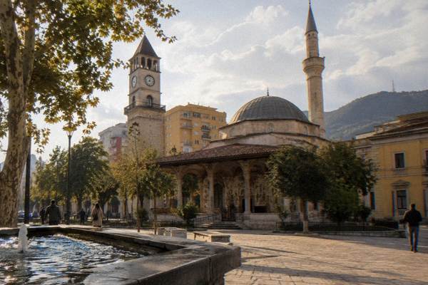
Tirana is a compact capital where the areas that matter to a visitor sit within a few kilometres of Skanderbeg Square. This guide maps each neighbourhood, its anchor sights and how the districts compare for a first visit, a food stop or a longer stay.
Short answer
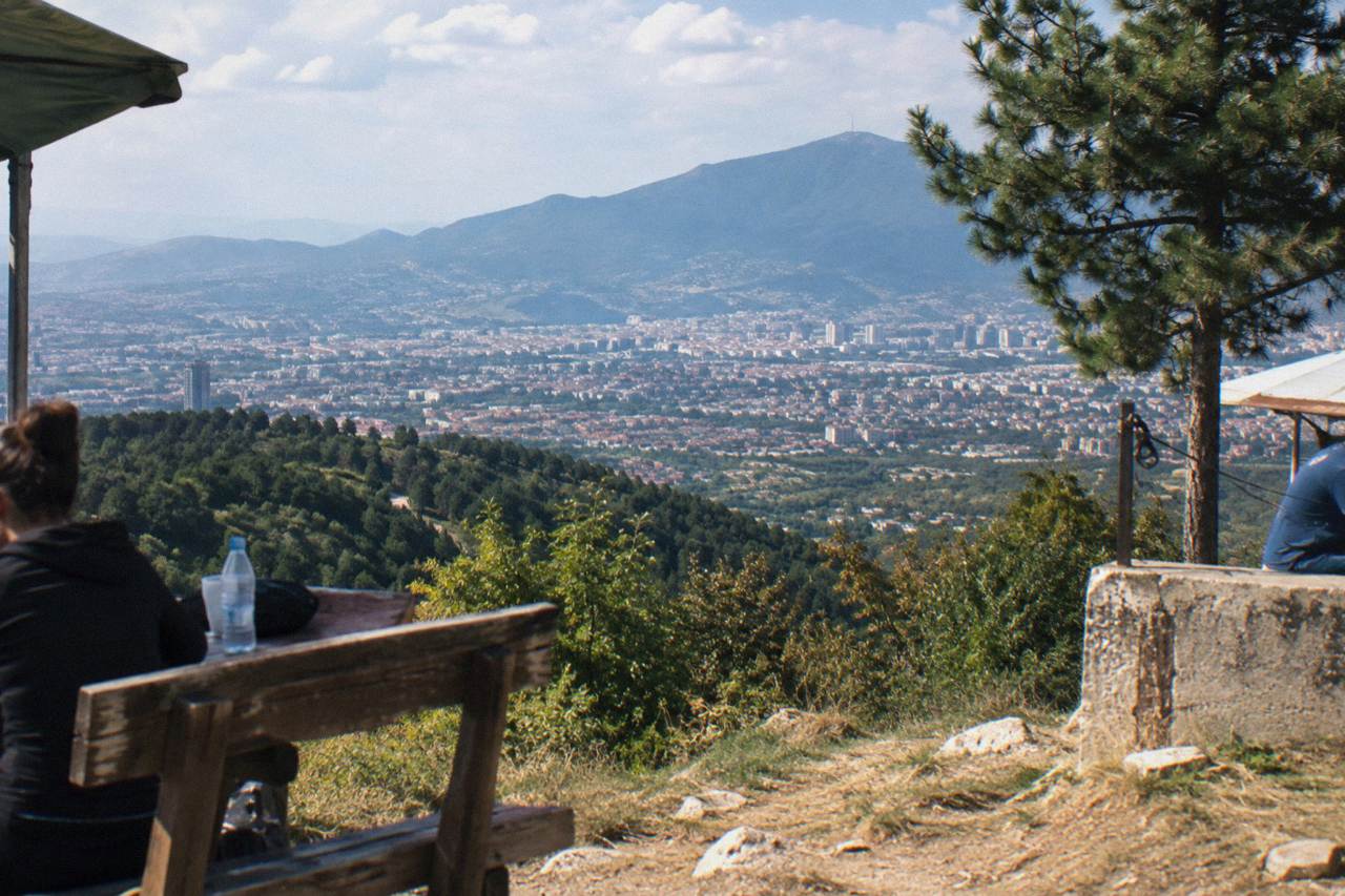
First-time visitors should base themselves in the city centre or Blloku: the centre holds Skanderbeg Square, the Et'hem Bey Mosque and Bunk'Art 2, while Blloku, about 0.8 km south, is the cafe and nightlife quarter. Komuna e Parisit, about 1.8 km south-west, suits longer stays, and Tirana e Re sits closest to the Dajti Ekspres cable car.
Tirana is the capital of Albania, an inland city in a basin at the foot of Mount Dajti, with the Adriatic coast at Durres about 37 km and 39 minutes west by road. For a visitor the city breaks down into a handful of walkable areas: the centre around Skanderbeg Square, the cafe quarter of Blloku, the quieter residential district of Komuna e Parisit, a band of neighbourhoods stretching west, and Tirana e Re at the foot of the mountain. The site's own area guide to Tirana city centre covers the core in depth; this page puts every district side by side.
Which Areas Of Tirana Should A First-Time Visitor Know?
Six areas cover everything a first visit needs: the city centre around Skanderbeg Square; Blloku, the former VIP quarter turned cafe district about 0.8 km south; Komuna e Parisit about 1.8 km south-west; the western band of Rruga e Kavajes, 21 Dhjetori and Kombinat; Tirana e Re about 1.3 km south near the mountain; and Selite about 2.5 km south-west. Each is reachable on foot or with a short bus ride from the square.
Tirana is small by capital standards. The distances below are straight-line measurements from Skanderbeg Square, so walking routes run a little longer. What the table shows is how tightly the city clusters: even Kombinat, the farthest district on this list, sits under 5 km from the centre.
| Area | Distance from Skanderbeg Square | Direction | What anchors it |
|---|---|---|---|
| City centre | 0 km | At the square | Et'hem Bey Mosque, Clock Tower, Bunk'Art 2 |
| Blloku | about 0.8 km | south | Cafes, bars, the former leadership enclave |
| Komuna e Parisit | about 1.8 km | south-west | Residential blocks, local cafes |
| Rruga e Kavajes | about 0.5 km | west | Shops, route to Kombinat |
| 21 Dhjetori | about 1.3 km | west | Government buildings, wide boulevards |
| Tirana e Re | about 1.3 km | south | Closest area to the Dajti Ekspres lower station |
| Selite | about 2.5 km | south-west | Hills, quieter streets |
| Kombinat | about 4.9 km | west | Outlying residential and industrial quarter |
No neighbourhood in Tirana carries a published safety score or price level on any official page, so this guide describes position and anchor sights only. What can be said plainly is geographic: the centre, Blloku and the Grand Park chain together into one walkable spine running south from the square, while the western districts fan out along Rruga e Kavajes.
What Defines The City Centre Around Skanderbeg Square?
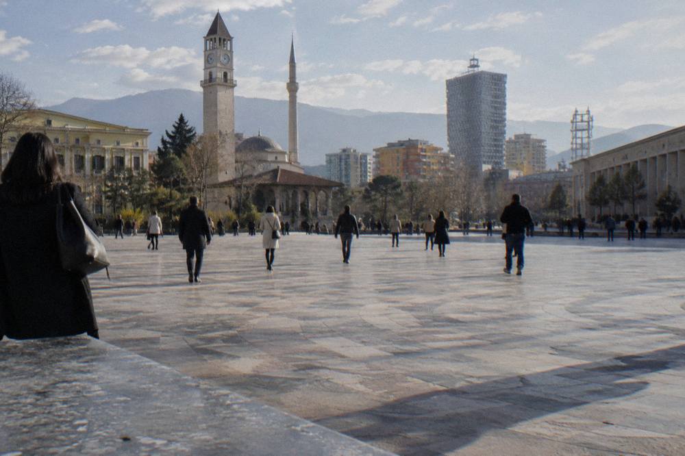
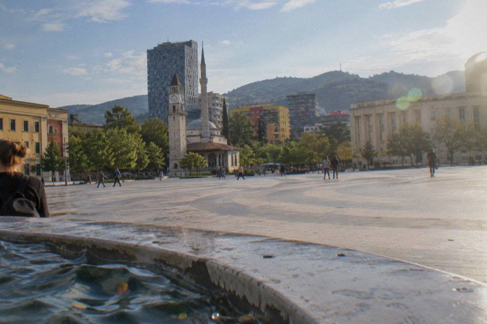
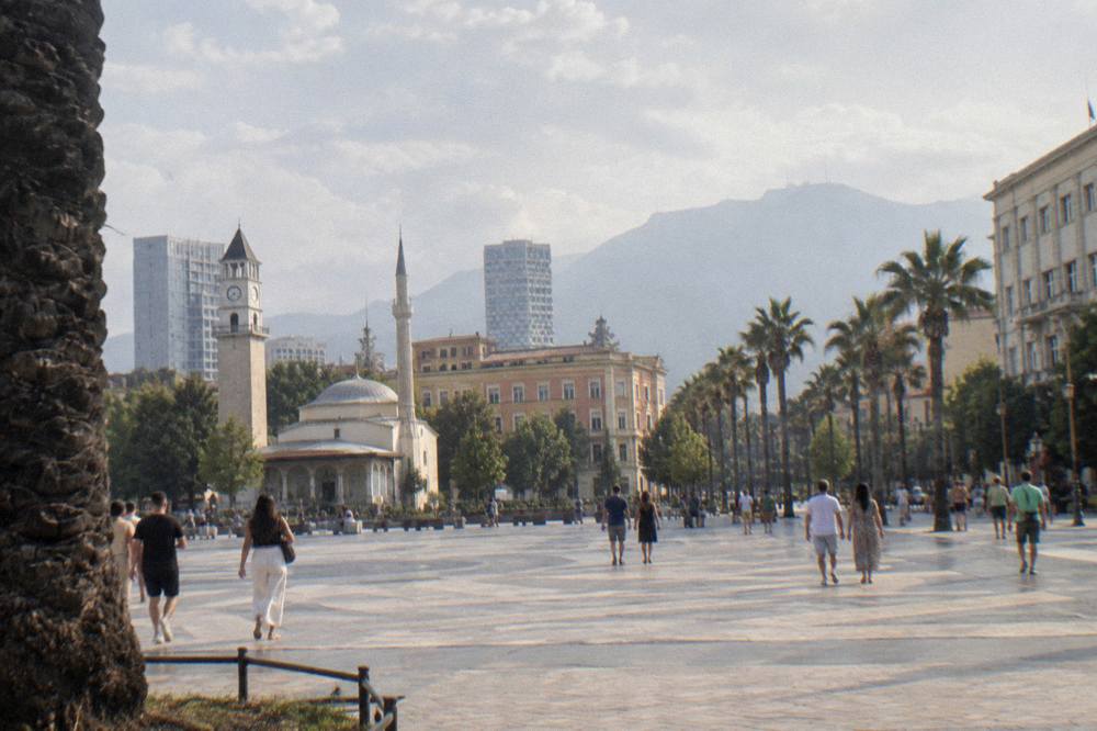
The centre is defined by Skanderbeg Square itself, the pedestrianised heart of Tirana that the national tourism agency calls one of the city's most important public spaces, ringed by the Et'hem Bey Mosque about 0.2 km south-east, the Clock Tower, the closed National History Museum and the Palace of Culture. Bunk'Art 2 sits about 0.2 km south-east and the Pyramid of Tirana about 0.7 km south-east, so the whole core fits inside a fifteen-minute walk.
The square was redesigned in 2017 as a pedestrian pyramid of stone, and it works as the orientation point for the entire city: every distance on this page is measured from it. Around it stand the buildings that carry Tirana's layered history, Ottoman, interwar Italian, communist and contemporary, within a few hundred metres of each other.
The current-conditions note for autumn 2026 belongs here, because the centre is where it applies: demonstrations have been held in central Tirana since 13 October 2026, some violent, and UK foreign office advice was updated on 15 October 2026. Visitors should avoid demonstrations and check local media. The Tirana Marathon was moved from late October to 14 and 15 November 2026 as a result.
Two permanent closures shape a centre itinerary. The National History Museum on the square has been closed for restoration since 15 March 2024, with the announced closure running to about March 2028; the mosaic facade can still be seen from the square. The National Gallery of Arts, about 0.4 km south-east, is under renovation, so check its status before going. What remains open nearby is rich: the Et'hem Bey Mosque is free to visit outside prayer times with modest dress, Bunk'Art 2 is open daily from 09:30, and the House of Leaves, about 0.2 km south-west, is open daily 09:00 to 19:00.
| Central sight | Straight-line distance from the square | Direction | Status in 2026 |
|---|---|---|---|
| Et'hem Bey Mosque | about 0.2 km | south-east | Open, free outside prayer times |
| Clock Tower | about 0.2 km | south-east | About 90 steps; confirm access on site |
| Bunk'Art 2 | about 0.2 km | south-east | Open daily from 09:30, tickets at the door |
| House of Leaves | about 0.2 km | south-west | Open daily 09:00 to 19:00 |
| National Gallery of Arts | about 0.4 km | south-east | Under renovation, check before going |
| Tirana Castle | about 0.5 km | south-east | Open public area |
| New Bazaar (Pazari i Ri) | about 0.6 km | east | Market and dining quarter |
| Pyramid of Tirana | about 0.7 km | south-east | Renovated, free to climb outside |
| National History Museum | on the square | On the square | Closed for restoration to about March 2028 |
A guided walk ties these together efficiently, and the classic option is the Tirana walking tour, which covers the core sights on foot with a local guide.
Why Is Blloku The Cafe And Nightlife Quarter Of Tirana?
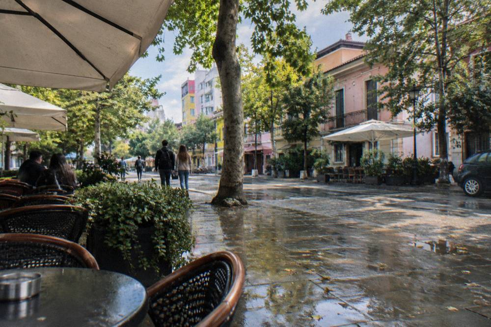
Blloku, about 0.8 km south of Skanderbeg Square, is a compact grid of streets lined with cafes, bars and restaurants, and local guides report it is where Tirana's nightlife concentrates. Its name comes from its communist-era past as a blocked-off residential enclave for the political leadership, a history marked today by the Postbllok memorial about 0.9 km south of the square at its edge.
The quarter's grid makes it easy to explore: cross the Lana from the centre along Bulevardi Zhan D'Ark or walk south from Rinia Park, about 0.4 km south of the square, and the streets fill with venues from late afternoon onward. No bar in Blloku posts reliable hours, so the practical advice is simple: wander, and pick by what is open. The area guide to Blloku goes deeper on the quarter's layout.
Food is part of the draw. Both may be named with that neutral description only. For a structured introduction to Albanian dishes, byrek the layered filo pie, qofte seasoned meatballs and tave kosi, baked lamb under a yogurt and egg topping, a guided food tour covers the tasting side of the city.
The evening options continue after dinner. Architecture and history walks run after dark, and the evening show with traditional music and dance is the ticketed cultural option in the city, an evening of folk performance with dinner.
What Is Komuna E Parisit Like For A Longer Stay?
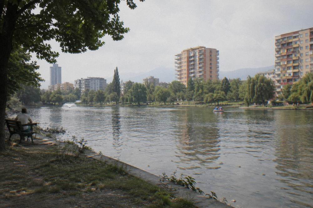
Komuna e Parisit, about 1.8 km south-west of Skanderbeg Square, is a mainly residential district of apartment blocks, local cafes and small shops, positioned between the centre and the Grand Park of Tirana about 2.1 km south-east of the square. It suits visitors planning a week or more who want quieter nights within reach of the centre by foot or a short city bus ride.
The district's practical advantage is position. Walking north-east brings you to Blloku in a few minutes and the square beyond it; walking south-east reaches the Grand Park of Tirana and the Artificial Lake, the city's main green space, both about 2.1 km from the square. The park's full guide is at Grand Park of Tirana.
City buses run roughly 06:00 to 23:00, and a single ride costs about 40 lek paid in cash on board, per local transport reporting.
Where Are The Western Districts: Rruga E Kavajes, 21 Dhjetori, Myslym Shyri And Kombinat?
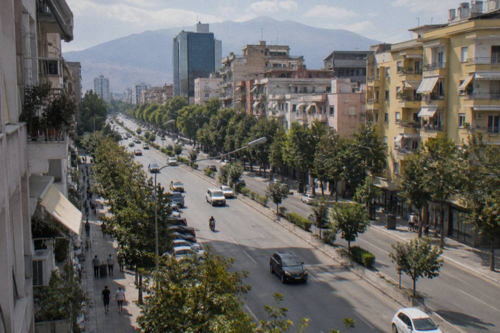
The western band runs from Rruga e Kavajes about 0.5 km west of Skanderbeg Square through Myslym Shyri about 1.1 km south-west and 21 Dhjetori about 1.3 km west, ending at Kombinat about 4.9 km west. Rruga e Kavajes is the shopping street of the chain, 21 Dhjetori holds government buildings and wide boulevards, and Kombinat is an outlying quarter near the road toward Durres.
This is the least touristy part of the city, and that is its appeal. Rruga e Kavajes functions as a long commercial street where locals shop; 21 Dhjetori mixes administrative buildings with apartment blocks; Kombinat, at the far western end, grew around industry and today is simply a neighbourhood where the city thins out toward the plain.
Two practical pointers sit on this side of town. The South and North Bus Terminal, from which buses leave for Durres, Berat, Shkoder and other cities, sits about 3.9 km north-west of the square, so it is closer to the western districts than the name suggests. And the road west out of the city leads toward Durres on the Adriatic, about 37 km and 39 minutes away, which makes the western side convenient for travellers combining Tirana with the coast.
Which Area Sits Closest To Mount Dajti And The Cable Car?
Tirana e Re, about 1.3 km south of Skanderbeg Square, is the area closest to the Dajti Ekspres cable car lower station, which sits about 4.4 km north-east of the square, with Bunk'Art 1 about 4.6 km north-east just behind the station. The cable car's operator describes it as the longest cableway in the Balkans, and the ride carries visitors up into Mount Dajti National Park.
The Dajti Ekspres does not publish fares online; tickets are sold only at the lower station, and the operator advises visiting the station for current prices. The service is usually closed on Tuesdays for maintenance, local guides report, so plan around that day. A half-day tour with the cable car ticket included is the guided alternative, and the full sight guide is at Dajti Ekspres.
Bunk'Art 1, the atomic bunker museum in the hills behind the lower station, is open daily 09:30 to 17:30 under its summer 2026 timetable, with tickets bought at the door; the museum publishes no online price. The deeper guide is at Bunk'Art 1. For the descent back into town, the Sky Tower about 0.7 km south of the square offers another vantage point over the city grid.
How Do Tirana's Neighbourhoods Compare For Eating, Walking And Views?
For eating, the centre around the New Bazaar and Blloku holds the densest choice; for walking, the centre-to-Grand-Park spine of about 2.1 km is the city's main pedestrian corridor; and for views, the winners are outside the neighbourhoods entirely, on Mount Dajti via the cable car or on the Pyramid's free steps about 0.7 km south-east of the square. Each area wins one category, and none wins all three.
| If you want | Best-placed area | Why | Key distance |
|---|---|---|---|
| Sightseeing on foot | City centre | Square, mosque, bunkers, castle all within 0.7 km | Everything under a 15-minute walk |
| Cafes and nightlife | Blloku | Dense grid of venues, about 0.8 km from the square | 10 to 12 minutes on foot |
| Food markets | New Bazaar area | Market hall and dining, about 0.6 km east | Under 10 minutes on foot |
| Green space and lake walks | Komuna e Parisit side | Grand Park and Artificial Lake about 2.1 km away | 25 to 30 minutes on foot |
| Mountain views | Tirana e Re side | Dajti Ekspres station about 4.4 km north-east | Short taxi or bus ride |
| Local, non-tourist streets | Rruga e Kavajes and west | Shopping street and residential blocks | Starts 0.5 km west |
A food tour anchors the eating category well: the guided tasting walks move through the centre and the bazaar area and introduce byrek, qofte and the rest of the Albanian repertoire without a visitor needing to research individual venues. The city-and-Dajti combo tour does the same for the walking-and-views category, pairing the centre with the cable car.
Which Neighbourhood Fits A One-Day, Two-Day Or Week-Long Trip?
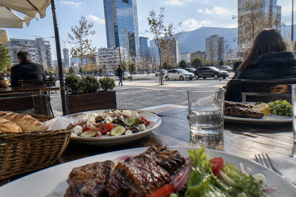
For one day, stay in the city centre: every core sight sits within 0.7 km of the square. For two or three days, add Blloku for evenings and the Grand Park or Mount Dajti for green half-days. For a week, base yourself in Blloku or Komuna e Parisit and use the day-trip ring: Kruja 45 minutes by road, Durres 39 minutes, Berat about two hours, each from the capital.
The site's itinerary guides carry the detail: one day in Tirana, two days in Tirana, three days in Tirana and one week in Albania from Tirana. The pattern behind all four is the same: the neighbourhoods are close enough that the choice of base matters less than the choice of day trips.
| Trip length | Best base | Fill the days with |
|---|---|---|
| One day | City centre | Square, Et'hem Bey Mosque, Bunk'Art 2, Pyramid |
| Two days | Centre or Blloku | Add Blloku evening, Grand Park, New Bazaar |
| Three days | Centre or Blloku | Add Dajti Ekspres and Bunk'Art 1 |
| One week | Blloku or Komuna e Parisit | Add Kruja, Durres, Berat, Shkoder day trips |
The day-trip ring deserves its own note on distances. Kruja, the castle town tied to Skanderbeg's rebellion, is 36.7 km and about 45 minutes by road. Durres and its Roman amphitheatre are 37.2 km and about 39 minutes west on the road to the coast. Berat, the UNESCO-listed town of windows, is 124.6 km and about two hours. The far south, Gjirokaster at 209 minutes and Saranda at 248 minutes of driving, is an overnight proposition rather than a day trip.
When Is The Best Season To Explore Tirana's Neighbourhoods On Foot?
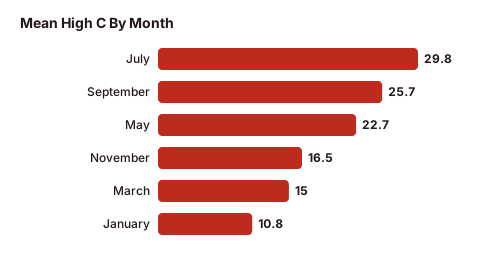
Late spring and early autumn are the comfortable walking seasons: May averages a high of 22.7 C and a low of 12.5 C with 89 mm of rain, and September averages 25.7 C and 16.0 C with 99 mm, per the ERA5 reanalysis for 1991-2020. July and August are hotter and drier, 29.8 C and 30.4 C mean highs with only 34 and 31 mm of rain, while November is the highest-rainfall month at 139 mm.
Tirana's neighbourhood walking is a fair-weather activity in any season, but the numbers matter for planning. Winter is mild rather than cold, with a January mean high of 10.8 C and mean low of 2.3 C, so a centre walk remains workable in a coat. The November and December rain totals, 139 mm and 138 mm, are the strongest argument for shifting a walking-heavy visit away from late autumn.
| Month | Mean high C | Mean low C | Rain mm |
|---|---|---|---|
| January | 10.8 | 2.3 | 106 |
| March | 15.0 | 5.1 | 117 |
| May | 22.7 | 12.5 | 89 |
| July | 29.8 | 19.1 | 34 |
| September | 25.7 | 16.0 | 99 |
| November | 16.5 | 8.0 | 139 |
These are climate normals from the ERA5 reanalysis, 1991-2020, for the grid cell over Tirana, not a weather-station record. The January or February edition of the city rewards the indoor sights, Bunk'Art 2, the House of Leaves and the cafes of Blloku, while the May-to-September window rewards the park, the mountain and the long pedestrian spine from the square south.
Common Questions About Tirana Neighbourhoods
Which Tirana neighbourhood is best for first-time visitors?
The city centre around Skanderbeg Square. Every core sight, from the Et'hem Bey Mosque to Bunk'Art 2 and the Pyramid of Tirana, sits within about 0.7 km of the square, and Blloku's cafes are a ten-minute walk south.
Is Blloku walkable from Skanderbeg Square?
Yes. Blloku begins about 0.8 km south of the square, roughly a ten to twelve minute walk, and the quarter itself is a compact grid best explored entirely on foot.
Where should I stay in Tirana for a longer trip?
Blloku and Komuna e Parisit both suit longer stays. Blloku puts the cafes at the door, while Komuna e Parisit, about 1.8 km south-west of the square, is quieter and sits between the centre and the Grand Park of Tirana.
Is Tirana a coastal city?
No. Tirana is inland, in a basin at the foot of Mount Dajti. The Adriatic coast at Durres is about 37 km and 39 minutes away by road and works as a day trip.
How do I get between Tirana neighbourhoods?
On foot for the centre, Blloku and the park. City buses run roughly 06:00 to 23:00 and a single ride costs about 40 lek paid in cash on board, per local transport reporting. There is no airport train; the airport bus runs 24/7, hourly, for 400 lek.
Which area is closest to the Dajti cable car?
Tirana e Re, about 1.3 km south of the square, is the nearest residential area to the Dajti Ekspres lower station at about 4.4 km north-east of the square. Bunk'Art 1 sits just behind the station.
For a deeper dive on any single district, continue with the area guides to Blloku, Komuna e Parisit and the Tirana city centre, and the full sight list on the Tirana Albania Travel Guide homepage.