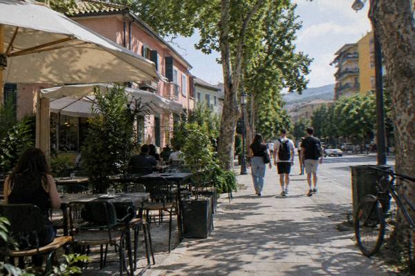
Tirana Photography Spots: Light, Colour And Concrete
Tirana photographs as a compact capital: one pedestrian square, a climbable pyramid, painted facades, two bunker museums and a cable car up Mount Dajti, all inside a basin ringed by hills.
Short answer
The strongest Tirana photography spots cluster within a 15-minute walk of Skanderbeg Square: the square itself with the Et'hem Bey Mosque and Clock Tower, the Pyramid of Tirana 0.7 km south-east, the New Bazaar 0.6 km east and Blloku 0.8 km south. Bunk'Art 1 and the Dajti Ekspres cable car sit 4.4 to 4.6 km north-east, and the Grand Park and Artificial Lake lie 2.1 km south-east.
Tirana is an inland capital in a basin at the foot of Mount Dajti, and its photography reflects that geography: dense, colour-drenched city blocks in the middle, a green mountain wall on the eastern edge, and the Adriatic coast at Durres only about 39 minutes away by road when a seaside frame calls. The city keeps its strongest subjects close together. The Pyramid of Tirana stands 0.7 km south-east of Skanderbeg Square, the New Bazaar 0.6 km east, Blloku 0.8 km south, and the Dajti Ekspres cable car lower station 4.4 km north-east. This guide walks through the frames worth planning around, the seasons that shape them, and the practical notes that decide whether a shot is easy or closed off.
Where Are Tirana's Signature Photography Spots?
Tirana's signature photography spots sit on a short list: Skanderbeg Square with the Et'hem Bey Mosque and the Clock Tower, the Pyramid of Tirana 0.7 km south-east, the Great Mosque of Tirana 0.6 km south-east, the New Bazaar 0.6 km east, Blloku 0.8 km south, the Grand Park and Artificial Lake 2.1 km south-east, and the Bunk'Art museums at 0.2 km and 4.6 km from the square. Every one of them is reachable on foot or with a single short bus or taxi ride, which is unusual for a capital city and is the reason a single productive day is realistic here. The state tourism agency describes Skanderbeg Square as one of Tirana's most important and best-known public spaces, and it works as the anchor for every route in this guide.
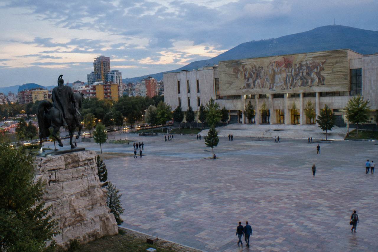
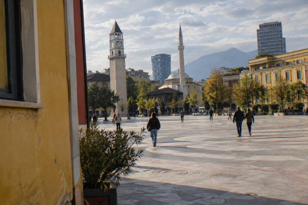
The square gives the city its classic composition: the equestrian Skanderbeg statue at the centre, the Et'hem Bey Mosque about 0.2 km south-east at its edge, the Clock Tower beside it, and the National History Museum's mosaic facade closing the northern side. One correction matters for planning: the National History Museum has been closed to visitors since 15 March 2024 for restoration, and the announced closure runs to March 2028. The mosaic facade remains viewable from the square, so it stays in the frame even though the interior does not. The square was redesigned as a pedestrian space by the 51N4E practice in 2017, per reporting on the project, which is why the ground plane photographs as clean stone rather than asphalt.
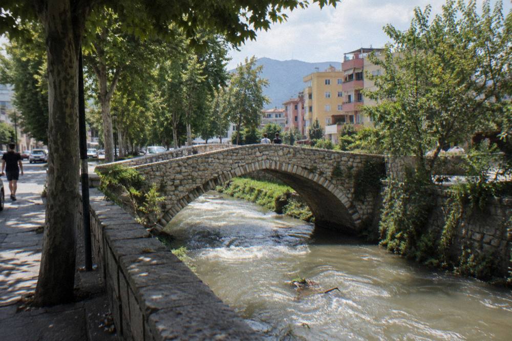
Around that anchor, the city sorts itself into walkable bands. The Tanners' Bridge lies 0.7 km east, a stone Ottoman bridge on a low street; Tirana Castle's block is 0.5 km south-east; the Postbllok memorial stands 0.9 km south on the boulevard; and the House of Leaves, the museum of secret surveillance, is only 0.2 km south-west of the square. The table below pulls the main spots into one planning view.
| Spot | Straight-line from Skanderbeg Square | What the frame holds | Access note |
|---|---|---|---|
| Skanderbeg Square and Et'hem Bey Mosque | On the square | Statue, mosque, Clock Tower, museum facade | Open public space; mosque visits outside prayer times |
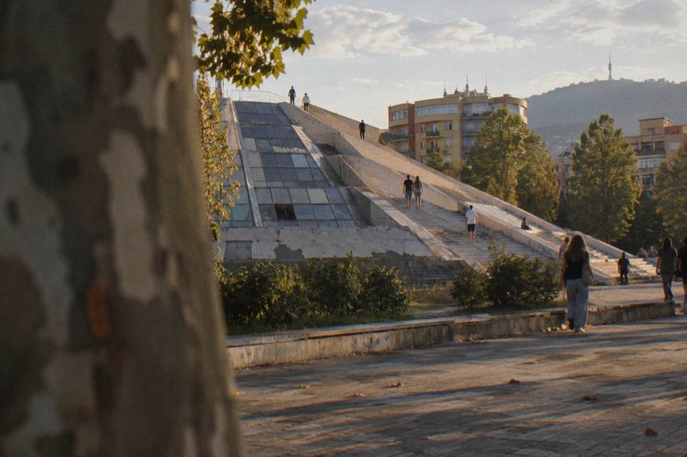
| Pyramid of Tirana | 0.7 km south-east | Climbable concrete steps over a renovated structure | Steps reported open and free |
| Great Mosque of Tirana (Namazgah) | 0.6 km south-east | Large new mosque, domes and minarets | Exterior from the street; visit between prayers |
| New Bazaar (Pazari i Ri) | 0.6 km east | Produce stalls, painted shopfronts, evening lights | Public market quarter |
| Blloku | 0.8 km south | Cafe facades, painted walls, nightlife streets | Public streets at all hours |
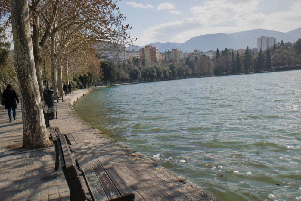
| Grand Park and Artificial Lake | 2.1 km south-east | Trees, lake shore, walkways | Public park |
| Tanners' Bridge | 0.7 km east | Ottoman stone bridge on a quiet street | Street-level, always visible |
| Postbllok memorial | 0.9 km south | Bunker, prison pillars, wall fragment on the boulevard | Street-level installation |
| Bunk'Art 2 | 0.2 km south-east | Interior tunnels of a secret police bunker | Open daily from 09:30; tickets at the door |
| Bunk'Art 1 | 4.6 km north-east | Full atomic-era bunker behind the cable car station | Open 09:30 to 17:30; tickets at the door |
For photographers who want the whole picture of the city rather than a single district, the main Tirana attractions overview lists everything worth scheduling, and the free things to do in Tirana guide covers the spots that cost nothing, which includes most of the exteriors on this page.
What Can You Photograph Around Skanderbeg Square?
Around Skanderbeg Square you can photograph the Skanderbeg statue, the Et'hem Bey Mosque, the Clock Tower, the mosaic facade of the closed National History Museum, the Palace of Culture, and, 0.2 km further, the House of Leaves and Bunk'Art 2, all inside roughly ten minutes of walking. The mosque is the oldest subject in the frame: reporting on the site records that it was begun at the end of the 18th century by Mulla Bey and finished by his son Haxhi Et'hem Bey, and that it survived the 1967 anti-religious campaign. On 18 January 1991 about 10,000 people entered it despite the authorities, a moment often cited in the city's transition story.
The mosque is free to visit outside prayer times, and the standard courtesy applies: shoulders and knees covered, a headscarf for women, shoes off inside. The Clock Tower beside it has about 90 steps to the top, and the current fee and opening arrangement is best checked at the venue before planning a climb. The National History Museum, again, is closed for restoration until about March 2028; photograph its facade, not its galleries. Bunk'Art 2, a museum inside a former Interior Ministry bunker, stands 0.2 km south-east of the square and is open daily from 09:30 per the museum's own site, with tickets bought at the door because no price is published online. The House of Leaves, 0.2 km south-west, is open Monday to Sunday 09:00 to 19:00 per the museum's site.
Two practical notes shape a square shoot. First, the square is a pedestrian space, so tripods and slow compositions are possible at quiet hours, though common sense about crowds applies. Second, central Tirana has seen demonstrations since 13 October 2026, some violent, and the UK FCDO updated its travel advice on 15 October 2026; avoid demonstrations, keep an eye on local media, and keep a flexible plan for the day. The Is Tirana Safe? Scams, Traffic And Night Walks covers the current picture in detail.
For photographers who want the buildings explained while walking them, the Tirana museums guide and the communist history sites in Tirana guide map out which interiors are open, closed or under renovation before you commit a morning to them.
How Do You Shoot The Pyramid Of Tirana And The Communist-Era Landmarks?
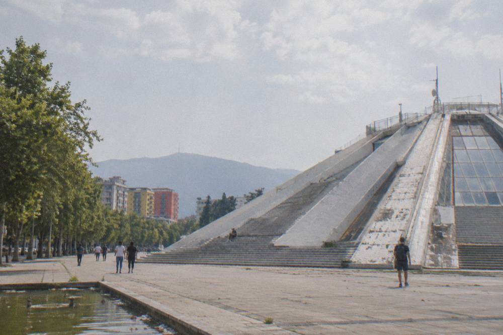
The Pyramid of Tirana, 0.7 km south-east of Skanderbeg Square, is the city's single most distinctive concrete subject: a structure opened on 14 October 1988, renovated and reopened in May 2023 as the TUMO tech centre, with outside steps that are reported open and free to climb. It is not a ruin and should not be shot as one; the renovation by the MVRDV practice turned it into a working building with an accessible sloped exterior. Wide lenses work at street level, and the stepped facade gives a strong graphic frame from its base. Interior hours and TUMO access are best confirmed directly before counting on an inside shot.
The communist-era thread continues past the Pyramid. The Postbllok memorial, 0.9 km south on the boulevard, combines a bunker, pillars from the Spac prison and a fragment of the Berlin Wall in one street-level installation, and it photographs at any hour because it sits on open ground. Bunk'Art 1, 4.6 km north-east behind the Dajti Ekspres lower station, is the fullest bunker interior near the city: the museum's own site lists it open 09:30 to 17:30 daily since 1 June 2026, and tickets are bought at the door because no price is published online. Inside, the tunnels and hardware are the frames; a fast lens helps because the corridors are dim.
A guided small-group walk of the communist landmarks ties these sites into one narrative, and it suits photographers who would rather have someone else sequence the route while they concentrate on frames. The buildings are scattered enough that a route matters: the Pyramid, Postbllok and Blloku line up along one southward axis from the square, while Bunk'Art 1 sits out at the far north-east edge beside the cable car, which makes a natural pairing of bunker interior and mountain panorama in a single trip. The Bunk'Art and Dajti combination tour below handles that pairing with transport and lunch included.
Which Viewpoints Give You The Tirana Skyline?
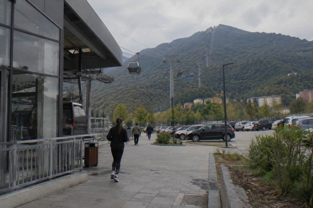
Tirana's named viewpoints are the Pyramid steps 0.7 km south-east of the square, the Clock Tower about 0.2 km south-east with roughly 90 steps, and the Mount Dajti cable car and summit reached from the Dajti Ekspres lower station 4.4 km north-east, with the Sky Tower building at 0.7 km south as a further landmark. The Pyramid steps are reported open and free to climb, which makes them the easiest elevated frame in the centre. The Clock Tower is the classic one, small and central, with its current access arrangements checked at the venue. The cable car is the big one: the Dajti Ekspres is billed by its operator as the longest cableway in the Balkans, and it lifts the camera from the basin to a mountain overlooking the whole city.
The cable car's operating pattern needs a little planning. The operator sells tickets only at the lower station and publishes no fares online, so budget cash and time for the booth; the line is reported busy on national holidays, with the operator suggesting arrival between 09:00 and 11:00 on those days, and it is usually closed on Tuesdays for maintenance, a detail local guides report and worth confirming before you go. The summit area sits inside Mount Dajti National Park, whose trails and clearings give forested foregrounds against the city haze below; the Mount Dajti National Park guide covers the park itself.
A half-day Dajti trip with the cable car ticket handled removes the one friction at the lower station, and it pairs naturally with a morning at Bunk'Art 1 next door. Other pages covering the same trip are gathered on Tirana Albania Travel Guide.
What Does Colour Photography In Tirana Look Like?
Colour photography in Tirana centres on the painted facades tradition of the city centre, the produce and shopfront colours of the New Bazaar 0.6 km east, the cafe walls of Blloku 0.8 km south, and the evening lights of the same quarter, with the pedestrian square and its mosque as the historical counterweight.
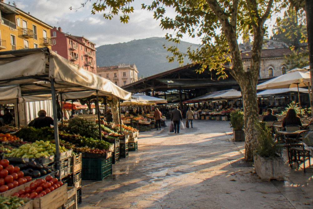
The New Bazaar is the market frame: produce, painted shopfronts and a compact grid that fills with people. Blloku, the former leadership quarter turned cafe district, is where evening colour lives; it is reported across local guides as Tirana's main cafe and bar quarter, and its streets are public and walkable at night, with the usual advice to watch your belongings in crowds. For photographers building a full day around food and market colour as well, the Albanian food guide and the best restaurants in Tirana guide list the names that are safe to plan around, and the Tirana nightlife guide covers the evening end of Blloku.
A route suggestion for a colour day, built from the positions above:
| Route | Sequence | Key frames | Practical note |
|---|---|---|---|
| Centre colour loop | Square, east to Tanners' Bridge, New Bazaar, back via Tirana Castle | Market stalls, painted shopfronts, stone bridge | Flat walking, about 2 km total |
| Communist axis | Square, south past Rinia Park to Postbllok, then Blloku | Memorial, boulevard, cafe walls | Straight line south, easy to follow |
| Park and lake | South to Mother Teresa Square, Grand Park, Artificial Lake | Tree lines, shoreline, rowboats | Public park, shade in summer afternoons |
| Bunker and mountain | Dajti Ekspres lower station, Bunk'Art 1, cable car to Dajti | Bunker tunnels, cable car cabins, summit panorama | Allow a half day; Tuesday closure reported |
When Is The Right Season For Photography In Tirana?
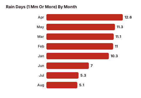
The right season for photography in Tirana depends on the frame: July and August bring the highest mean highs, 29.8 C and 30.4 C respectively, with the lowest rainfall of the year at 34 mm and 31 mm, while November and December carry the heaviest rain, 139 mm and 138 mm, and January the lowest mean low at 2.3 C, according to the ERA5 reanalysis for Tirana, 1991-2020. In plain terms, summer delivers stable, hot, dry shooting days with harsh midday light, spring and autumn trade some rain for softer conditions, and winter is mild on the highs but wet from late October onward. The monthly detail, rain days included, is in the table below.
| Month | Mean high C | Mean low C | Rain mm | Rain days (1 mm or more) |
|---|---|---|---|---|
| Jan | 10.8 | 2.3 | 106 | 10.3 |
| Feb | 12.0 | 2.9 | 107 | 11.0 |
| Mar | 15.0 | 5.1 | 117 | 11.1 |
| Apr | 18.4 | 8.4 | 105 | 12.6 |
| May | 22.7 | 12.5 | 89 | 11.3 |
| Jun | 26.9 | 16.6 | 51 | 7.0 |
| Jul | 29.8 | 19.1 | 34 | 5.3 |
| Aug | 30.4 | 19.5 | 31 | 5.1 |
| Sep | 25.7 | 16.0 | 99 | 9.4 |
| Oct | 21.4 | 12.2 | 119 | 9.5 |
| Nov | 16.5 | 8.0 | 139 | 11.2 |
| Dec | 11.8 | 4.0 | 138 | 12.0 |
These are averages from the 1991-2020 ERA5 reanalysis, a modelled grid rather than a station record, so treat them as planning normals with a degree or two of give. October stands out in the table as a transitional month: a mean high of 21.4 C but 119 mm of rain across 9.5 rain days. April shows the highest rain-day count of the year at 12.6 even as highs climb to 18.4 C. For photographers, the practical reading is that a spare battery, a rain sleeve and a flexible indoor backup, the bunker museums, matter more from October to April, while summer planning is about heat and midday glare. The month-by-month breakdown continues in the Tirana weather guide and the best time to visit Tirana guide.
What Should You Pack For A Photography Day In Tirana?
For a photography day in Tirana, pack for mixed light and mixed interiors: a fast lens for the dim bunker corridors, a wide lens for the square and the Pyramid, comfortable walking shoes for a compact but hilly-edged city, cash in lek for market stalls and museum doors, and a rain sleeve from October to April when monthly rainfall runs over 100 mm in the ERA5 1991-2020 normals. None of the city-centre spots listed above needs a permit; the paid interiors, Bunk'Art 1 and 2 and the House of Leaves, sell tickets at the door, and neither Bunk'Art site publishes its price online, so carry more cash than you expect to need and check the current price at the venue.
| Subject | Kit that earns its place | Why |
|---|---|---|
| Skanderbeg Square | Wide lens, polariser | Open stone plane, harsh summer glare |
| Et'hem Bey Mosque interior | Modest lens, no flash mindset | Free entry outside prayer times, dress courtesy applies |
| Bunk'Art tunnels | Fast prime, high-ISO body | Dim corridors, no published interior lighting detail |
| Pyramid steps | Wide or 35 mm | Stepped facade from the base, geometric lines |
| Cable car and Dajti summit | Telephoto for city compression | 4.4 km from the square to the lower station, long views from the top |
| New Bazaar and Blloku evening | Standard zoom, small flash | Crowded, colourful, low light after dark |
A few practicalities round out the bag. Plugs are type C and F at 230 V, so EU chargers fit without an adapter. Cards are reported widely accepted in hotels, larger restaurants and supermarkets in central Tirana, while cash in lek remains the working currency for buses, markets and small cafes; the Albanian lek guide explains the currency and the Tirana prices guide covers budgeting. A single city-bus ride costs about 40 lek, paid in cash on board, per local transport reporting, and buses run roughly 06:00 to 23:00; the getting around Tirana guide has the detail. If you are arriving with a bag full of gear, the Tirana airport to city centre guide covers the 400 lek airport bus and the official airport taxi, and the Albania entry requirements guide covers the visa regime, which is Albania's own 90-in-180 system, not Schengen's.
Which Day Trips From Tirana Reward The Camera?
The day trips from Tirana that most reward the camera are Durres on the Adriatic about 39 minutes away by road, Kruja about 45 minutes, Petrela Castle about 22 minutes, Lake Bovilla about 61 minutes and Pellumbas Cave about 47 minutes, with Berat at about two hours, Shkoder at about two hours and Ohrid at about 135 minutes plus a border crossing. The short list works as half-day photography trips; the middle list needs most of a day; and the far south, Gjirokaster, Saranda, Ksamil and Butrint at about 3.5 to 4.5 hours each way, is overnight territory and should be planned as such.
| Destination | Drive time from Skanderbeg Square | Photographic subject |
|---|---|---|
| Petrela Castle | about 22 minutes | Hilltop castle walls above the valley |
| Durres | about 39 minutes | Roman amphitheatre, Adriatic beach, port |
| Kruja | about 45 minutes | Castle, old bazaar, mountain backdrop |
| Pellumbas Cave | about 47 minutes | Karst cave in a gorge |
| Lake Bovilla | about 61 minutes | Green reservoir ringed by cliffs |
| Shkoder | about 118 minutes | Rozafa Castle, lake, old streets |
| Berat | about 122 minutes | UNESCO-listed whitewashed houses climbing the hill |
| Ohrid | about 135 minutes plus the border | Lake and old town in North Macedonia |
Berat deserves its own note for photographers: the historic centres of Berat and Gjirokastra are inscribed together on the UNESCO World Heritage list, Berat added in 2008, and the Onufri Iconographic Museum there charges 400 lek and the Ethnographic Museum 300 lek, per the Berat museum centre's own visit page, with the castle grounds possibly carrying a small gate fee. Durres combines a Roman amphitheatre and a sandy beach, and its Archaeological Museum and amphitheatre charge a few hundred lek each, per local reporting, so confirm on arrival. For the coastal option, the Tirana to Durres guide covers the route. If you would rather ride than drive, the car rental in Tirana guide and the driving in Albania guide cover the practical side, and the Tirana bus stations guide covers departures from the South and North terminal 4.0 km north-west of the square.
Guided day trips simplify the distances above, and for Berat, whose lanes and castle are easier with someone else handling the road, the tour below covers the UNESCO town and Belshi Lake in one outing.
How Do You Photograph Tirana Respectfully?
Photograph Tirana respectfully by following three rules: dress modestly and remove shoes at the Et'hem Bey Mosque and visit outside prayer times, treat the House of Leaves and Bunk'Art museums as memorial sites as well as photo sets, and avoid demonstrations, which have been held in central Tirana since 13 October 2026, with the FCDO updating its advice on 15 October 2026. People photography in the market and streets works best with a greeting and a nod; Albania has no state religion and its 2023 census, as reported by ATA, shows Muslim about 45.9 percent, Catholic about 8.4 percent and Orthodox about 7.2 percent, with large shares not declaring, so the city's religious buildings sit side by side and deserve equal courtesy.
Emergency numbers, should a shoot go wrong: Police 112, Ambulance 127, Fire 128. The FCDO advises avoiding demonstrations and monitoring local media, and its health page advises drinking bottled water rather than tap water in Albania. The Albania travel tips guide collects the rest of the practicalities, and the where to stay in Tirana guide positions you within walking distance of the frames above.
Common Questions About Photographing Tirana
Where Are The Best Tirana Photography Spots?
The signature spots are Skanderbeg Square with the Et'hem Bey Mosque and Clock Tower, the Pyramid of Tirana 0.7 km south-east, the New Bazaar 0.6 km east, Blloku 0.8 km south, the Grand Park and Artificial Lake 2.1 km south-east, and the Bunk'Art museums at 0.2 km and 4.6 km from the square, with the Dajti Ekspres cable car at 4.4 km north-east for the mountain panorama.
Can You Photograph Inside Bunk'Art?
Bunk'Art 1 is open 09:30 to 17:30 daily per its own site, and Bunk'Art 2 is open daily from 09:30; tickets are bought at the door because no price is published online. Photography inside is generally part of the visit, but confirm the current rules at the door, and bring a fast lens because the corridors are dim.
Can You Climb The Pyramid Of Tirana For A Photo?
Yes, as far as reporting goes: the Pyramid, opened in 1988 and reopened in May 2023 as the TUMO tech centre, has outside steps that local guides report open and free to climb. Interior hours and TUMO access are best confirmed directly, and the building should be photographed as a renovated structure, not a ruin.
What Is The Best Season For Photography In Tirana?
By the ERA5 reanalysis 1991-2020 normals, July and August are the dry months, with 34 mm and 31 mm of rain and mean highs of 29.8 C and 30.4 C, while November and December are the wet ones, with 139 mm and 138 mm. Spring and autumn trade moderate rain for milder light, and January's mean low of 2.3 C makes winter shooting cold but workable.
Do You Need A Permit To Photograph In Tirana?
No permit is needed for the public spaces on this page: the square, streets, parks, bazaar and market are open to photograph. Religious buildings ask for modest dress and visits outside prayer times, and the ticketed interiors, Bunk'Art 1 and 2 and the House of Leaves, sell admission at the door.
Which Viewpoint Gives The Best Tirana Panorama?
The Dajti Ekspres cable car, from its lower station 4.4 km north-east of the square, lifts you to Mount Dajti for the widest city panorama, and the operator bills it as the longest cableway in the Balkans. Tickets are sold only at the lower station, no fare is published online, and it is reported usually closed on Tuesdays, so plan around that and confirm before going.
From the square's stone plane to the mountain wall above the basin, Tirana keeps its frames within a short radius of one another, and that compactness, more than any single viewpoint, is what makes the city such a productive place to shoot. Pack for colour, carry cash for the doors, and let the basin do the rest.